Weston Rhyn Crossing
Introduction
The photograph on this page of Weston Rhyn Crossing by Stephen McKay as part of the Geograph project.
The Geograph project started in 2005 with the aim of publishing, organising and preserving representative images for every square kilometre of Great Britain, Ireland and the Isle of Man.

There are currently over 7.5m images from over 14,400 individuals and you can help contribute to the project by visiting https://www.geograph.org.uk
Weston Rhyn Crossing
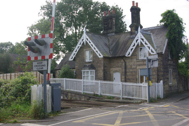
Image: © Stephen McKay Taken: 9 Oct 2008
Still a busy line between Shrewsbury and Chester, but the station here at Weston Rhyn was closed in September 1960. The station was called Preesgweene until 1935.
Images are licensed for reuse under creativecommons.org/licenses/by-sa/2.0
Image Location
Latitude
52.917191
Longitude
-3.053652