Railway at Downshire
Introduction
The photograph on this page of Railway at Downshire by Albert Bridge as part of the Geograph project.
The Geograph project started in 2005 with the aim of publishing, organising and preserving representative images for every square kilometre of Great Britain, Ireland and the Isle of Man.

There are currently over 7.5m images from over 14,400 individuals and you can help contribute to the project by visiting https://www.geograph.org.uk
Railway at Downshire
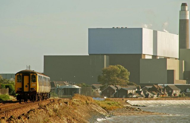
Image: © Albert Bridge Taken: 11 Oct 2008
The railway follows the shore of Belfast Lough between Whitehead and Downshire Image The 10.27 Larne Harbour – Belfast (Gt Victoria Street) is approaching Downshire station. Kilroot power station Image dominates the background.
Images are licensed for reuse under creativecommons.org/licenses/by-sa/2.0
Image Location
Latitude
54.722014
Longitude
-5.786658