Chipstead Valley Road, Coulsdon
Introduction
The photograph on this page of Chipstead Valley Road, Coulsdon by Dr Neil Clifton as part of the Geograph project.
The Geograph project started in 2005 with the aim of publishing, organising and preserving representative images for every square kilometre of Great Britain, Ireland and the Isle of Man.

There are currently over 7.5m images from over 14,400 individuals and you can help contribute to the project by visiting https://www.geograph.org.uk
Chipstead Valley Road, Coulsdon
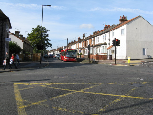
Image: © Dr Neil Clifton Taken: 10 Oct 2008
Looking south-west from the junction with Lion Green Road. The bus on Route 166 is (Arriva) DWL 3 and is on its way to West Croydon. Route 166 began in 1950 when its northern terminus was Thornton Heath (High Street) via Brigstock Road, thus it was a partial replacement for the No. 42 trams. In those days, it was worked by 'RT' double deckers, the southern terminus being Chipstead Valley (Mid Day Sun). In 1970, the northern end of the route was altered to become Shirley (Monks Orchard Road), and single-deck 'SMS' class standee buses were introduced, which were very unpopular with the passengers, who referred to them as 'cattle trucks'. Eventually, double deckers came back in the form of DMS vehicles, later replaced by Olympians, but in 2000 when the trams started running to New Addington, Route 166 was cut back to West Croydon, but received an extension to Banstead (later Epsom) at the southern end: all workings became single-deck again, various classes being used.
Images are licensed for reuse under creativecommons.org/licenses/by-sa/2.0
Image Location
Latitude
51.319845
Longitude
-0.141169