Overview for Leys Lane, MARAZION, TR17 0AQ
Introduction
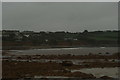
Marazion is a civil parish and town, on the shore of Mount's Bay in Cornwall, England, United Kingdom. It is 2 miles (3.2 km) east of Penzance and the tidal island of St Michael's Mount is half-a-mile offshore. At low water a causeway links it to the town and at high water passenger boats carry visitors between Marazion and St Michael's Mount.
Marazion is a tourist resort with an active community of artists who produce and sell paintings and pottery in the town's art galleries.
Marazion lies within the Cornwall Area of Outstanding Natural Beauty (AONB). Almost a third of Cornwall has AONB designation, with the same status and protection as a National Park. On the western side of the town is Marazion Marsh, a RSPB reserve and a Site of Special Scientific Interest (SSSI).
Summary for Leys Lane, MARAZION, TR17 0AQ
Roadworks near TR17 0AQ
Road Safety near TR17 0AQ
Details of personal injury accidents in and around Leys Lane, TR17 0AQ that have been reported to Devon & Cornwall Police over the past 20 years.
Traffic Levels near TR17 0AQ
View traffic levels near Leys Lane, TR17 0AQ from official Department for Transport counts.
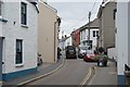
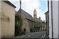
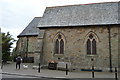
Images taken near to Leys Lane, TR17 0AQ and the surrounding area
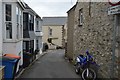
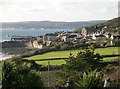
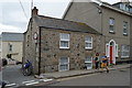
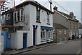


Please click the More button for more images, licensing and image copyright information.
Member of UK Parliament
Unfortunately, Parliamentary details are not available for this postcode.
Most Recent House Sales for Leys Lane, TR17 0AQ
1 Jun 2022
24 May 2019
3 Apr 2018
3 Dec 2015
Local Petrol Station Prices
Coordinates for TR17 0AQ
Residents at TR17 0AQ
Sunrise and Sunset at TR17 0AQ
Traffic Emission and Congestion Zones
Historical Weather Summary
| Clear | 7.54% |
| Cloudy | 30.08% |
| Rain | 10.92% |
| Windy | 51.46% |
| Other | 0.00% |
Population
Deprivation Index
the more deprived the postcode
Average Energy Performance
Companies Registered at TR17 0AQ
Postcode Details for TR17 0AQ
Recent Updates
|
18 Apr 2024 Added Traffic Camera Views from Traffic Scotland to Roadworks within Scotland |
|
15 Apr 2024 Schools Data updated for April 2024 |
|
10 Apr 2024 Companies Data updated for March 2024 |
|
7 Apr 2024 New option to receive automatic updates to roadworks that affect you |
|
7 Apr 2024 Police and Crime data updated for February 2024 |
|
3 Apr 2024 Sold House Price data updated for February 2024 |
|
30 Mar 2024 Energy Performance Certificates (England and Wales) updated February 2024 |
|
28 Mar 2024 New feature to use Geolocating functions to detect your current location |
Random Postcodes
Want an idea of what is in our extensive website? Try somewhere completely random!
The Rural/Urban classification is based upon data collected during the 2011 Census and released in August 2013 and is categorised into 6 distinct classes.
[A] Urban Major conurbation: A built up area with a population of 10,000 (3,000 in Scotland) or more and is assigned to the major conurbation settlement category.
[B] Urban Minor conurbation: A built up area with a population of 10,000 (3,000 in Scotland) or more and is assigned to the minor conurbation settlement category.
[C] Urban City and town: A built up area with a population of 10,000 (3,000 in Scotland) or more and is assigned to the city and town settlement category.
[D] Rural Town and fringe
[E] Rural Village
[F] Rural Hamlet and isolated dwelling
The Index of Multiple Deprivation (IMD) is the official measure of relative deprivation.
The index is based on 39 separate indicators across seven distinct domains (Income; Employment; Health and Disability; Education, Skills and Training; Crime; Barriers to Housing and Services; Living Environment) to provide an overall measure of multiple deprivation and is calculated for every neighbourhood.
The index is relative rather than an absolute scale and so a neighbourhood with a score of 10 is more deprived than one rated 20, but this does not equate to being twice as deprived.
Please note: Different indices are used in England, Scotland, Wales and Northern Ireland and so comparison of scores from neighbourhoods in different countries should not be undertaken.
These figures report on incorporated UK companies only that are registered at this postcode and do not include sole-traders, partnerships or overseas organisations.
The population figure shown for your area are an estimate provided by the Office for National Statistics and is rounded to the nearest 1,000.
The estimates are derived from the Annual Population Survey (APS) which is the Labour Force Survey (LFS) plus various sample boosts.
There are 55 unitary authorities. They provide all local government services in their areas. These are mainly in the cities, urban areas and larger towns although there are now 6 shire county councils that are unitary (ie have no district councils beneath them).