Overview for Old Cleeve, MINEHEAD, TA24 6HU
Introduction
Minehead is a coastal town and civil parish in Somerset, England. It lies on the south bank of the Bristol Channel, 21 miles (34 km) north-west of the county town of Taunton, 12 miles (19 km) from the boundary with the county of Devon and in proximity of the Exmoor National Park. The parish of Minehead has a population of approximately 11,981, making it the most populous town in the western part of the now-defunct Somerset West and Taunton local government district, which in turn, is the worst area in the country for social mobility. This figure includes Alcombe and Woodcombe, suburban villages which have been subsumed into Minehead.
There is evidence of human occupation in the area since the Bronze and Iron Ages. Before the Norman conquest, it was held by Ælfgar, Earl of Mercia and after it by William de Moyon and his descendants, who administered the area from Dunster Castle, which was later sold to Sir George Luttrell and his family. There was a small port at Minehead by 1380, which grew into a major trading centre during the medieval period. Most trade transferred to larger ports during the 20th century, but pleasure steamers did call at the port. Major rebuilding took place in the Lower or Middle town area following a fire in 1791 and the fortunes of the town revived with the growth in sea bathing, and by 1851 was becoming a retirement centre. There was a marked increase in building during the early years of the 20th century, which resulted in the wide main shopping avenue and adjacent roads with Edwardian-style architecture. The town's flood defences were improved after a storm in 1990 caused flooding.
Minehead is governed by a town council, which was created in 1983. In addition to the parish church of St. Michael on the Hill in Minehead, the separate parish church of St Michael the Archangel is situated in Church Street, Alcombe. Alcombe is also home to the Spiritualist Church in Grove Place. Since 1991, Minehead has been twinned with Saint-Berthevin, a small town close to the regional centre of Laval in the Mayenne département of France. Blenheim Gardens, which is Minehead's largest park, was opened in 1925. The town is also the home of a Butlins Holiday Park which increases Minehead's seasonal tourist population by several thousand.
There is a variety of schools and religious, cultural and sporting facilities including sailing and wind surfing and golf. One popular ancient local tradition involves the Hobby Horse which takes to the streets for four days on the eve of the first of May each year, with accompanying musicians and rival horses. The town is the starting point of the South West Coast Path National Trail, the nation's longest long-distance countryside walking trail. The Minehead Railway was opened in 1874 and closed in 1971 but has since been reopened as the West Somerset Railway.
Summary for Old Cleeve, MINEHEAD, TA24 6HU
Roadworks near TA24 6HU
Road Safety near TA24 6HU
Details of personal injury accidents in and around TA24 6HU that have been reported to Avon and Somerset Constabulary over the past 20 years.
Traffic Levels near TA24 6HU
View traffic levels near TA24 6HU from official Department for Transport counts.
Images taken in and around the ta246hu area
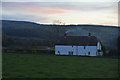
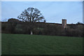
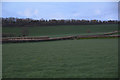
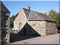
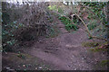
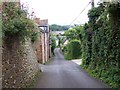


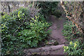
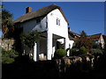
Please click the More button for more images, licensing and image copyright information.
Police
This area is policed by Avon and Somerset Constabulary.
Avon and Somerset Constabulary split their policing area into 123 separate neighbourhoods and this postcode is in the Williton and Watchet neighbourhood.

Williton and Watchet Neighbourhood Crime
Top 3 Categories
For full details of all categories together with more crime information, click on the Details button.
Member of UK Parliament
This postcode is in the Bridgwater and West Somerset parliamentary constituency.
Bridgwater and West Somerset is a constituency in the South West region of England. The seat has been held by Mr Ian Liddell-Grainger (Conservative) since May 2010.

Most Recent House Sales for TA24 6HU
21 Jan 2019
10 Jul 2015
8 Jul 2008
3 Aug 2007
Local Petrol Station Prices
Coordinates for TA24 6HU
Residents at TA24 6HU
Sunrise and Sunset at TA24 6HU
Traffic Emission and Congestion Zones
Historical Weather Summary
| Clear | 19.65% |
| Cloudy | 64.88% |
| Rain | 7.84% |
| Windy | 7.30% |
| Other | 0.33% |
Deprivation Index
the more deprived the postcode
Average Energy Performance
Companies Registered at TA24 6HU
Postcode Details for TA24 6HU
Recent Updates
|
18 Apr 2024 Added Traffic Camera Views from Traffic Scotland to Roadworks within Scotland |
|
15 Apr 2024 Schools Data updated for April 2024 |
|
10 Apr 2024 Companies Data updated for March 2024 |
|
7 Apr 2024 New option to receive automatic updates to roadworks that affect you |
|
7 Apr 2024 Police and Crime data updated for February 2024 |
|
3 Apr 2024 Sold House Price data updated for February 2024 |
|
30 Mar 2024 Energy Performance Certificates (England and Wales) updated February 2024 |
|
28 Mar 2024 New feature to use Geolocating functions to detect your current location |
Random Postcodes
Want an idea of what is in our extensive website? Try somewhere completely random!
The Rural/Urban classification is based upon data collected during the 2011 Census and released in August 2013 and is categorised into 6 distinct classes.
[A] Urban Major conurbation: A built up area with a population of 10,000 (3,000 in Scotland) or more and is assigned to the major conurbation settlement category.
[B] Urban Minor conurbation: A built up area with a population of 10,000 (3,000 in Scotland) or more and is assigned to the minor conurbation settlement category.
[C] Urban City and town: A built up area with a population of 10,000 (3,000 in Scotland) or more and is assigned to the city and town settlement category.
[D] Rural Town and fringe
[E] Rural Village
[F] Rural Hamlet and isolated dwelling
The Index of Multiple Deprivation (IMD) is the official measure of relative deprivation.
The index is based on 39 separate indicators across seven distinct domains (Income; Employment; Health and Disability; Education, Skills and Training; Crime; Barriers to Housing and Services; Living Environment) to provide an overall measure of multiple deprivation and is calculated for every neighbourhood.
The index is relative rather than an absolute scale and so a neighbourhood with a score of 10 is more deprived than one rated 20, but this does not equate to being twice as deprived.
Please note: Different indices are used in England, Scotland, Wales and Northern Ireland and so comparison of scores from neighbourhoods in different countries should not be undertaken.
These figures report on incorporated UK companies only that are registered at this postcode and do not include sole-traders, partnerships or overseas organisations.
The population figure shown for your area are an estimate provided by the Office for National Statistics and is rounded to the nearest 1,000.
The estimates are derived from the Annual Population Survey (APS) which is the Labour Force Survey (LFS) plus various sample boosts.
There are 55 unitary authorities. They provide all local government services in their areas. These are mainly in the cities, urban areas and larger towns although there are now 6 shire county councils that are unitary (ie have no district councils beneath them).