Overview for Appleford Road, VENTNOR, PO38 3LE
Introduction
Ventnor is a seaside resort town and civil parish established in the Victorian era on the southeast coast of the Isle of Wight, England, eleven miles (18 km) from Newport. It is situated south of St Boniface Down, and built on steep slopes leading down to the sea. The higher part is referred to as Upper Ventnor (officially Lowtherville); the lower part, where most amenities are located, is known as Ventnor. Ventnor is sometimes taken to include the nearby and older settlements of St Lawrence and Bonchurch, which are covered by its town council. The population is 5,567 according to the 2021 CensusVentnor became extremely fashionable as both a health and holiday resort in the late 19th century, described as the 'English Mediterranean' and 'Mayfair by the Sea'. Medical advances during the early twentieth century reduced its role as a health resort and, like other British seaside resorts, its summer holiday trade suffered from the changing nature of travel during the latter part of the century.
Its relatively sheltered location beneath the hilly chalk downland and south-facing orientation towards the English Channel produces a microclimate with more sunny days and fewer frosts than the rest of the island. This allows many species of subtropical plant to flourish; Ventnor Botanic Garden is particularly notable. Ventnor retains a strongly Victorian character, has an active arts scene, and is regaining popularity as a place to visit.
Summary for Appleford Road, VENTNOR, PO38 3LE
Roadworks near PO38 3LE
Road Safety near PO38 3LE
Details of personal injury accidents in and around Appleford Road, PO38 3LE that have been reported to Hampshire Constabulary over the past 20 years.
Traffic Levels near PO38 3LE
View traffic levels near Appleford Road, PO38 3LE from official Department for Transport counts.
Images taken near to Appleford Road, PO38 3LE and the surrounding area
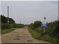
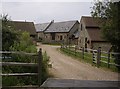
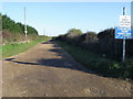
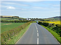
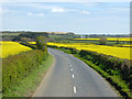

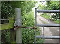
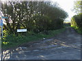
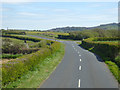
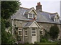
Please click the More button for more images, licensing and image copyright information.
Police
This area is policed by Hampshire Constabulary.
Hampshire Constabulary split their policing area into 95 separate neighbourhoods and this postcode is in the Wight Rural South neighbourhood.

Wight Rural South Neighbourhood Crime
Top 3 Categories
For full details of all categories together with more crime information, click on the Details button.
Member of UK Parliament
This postcode is in the Isle of Wight parliamentary constituency.
Isle of Wight is a constituency in the South East region of England. The seat has been held by Bob Seely (Conservative) since June 2017.

Most Recent House Sales for Appleford Road, PO38 3LE
No recorded house sales or transfers for this postcode.
Local Petrol Station Prices
Coordinates for PO38 3LE
Residents at PO38 3LE
Sunrise and Sunset at PO38 3LE
Traffic Emission and Congestion Zones
Historical Weather Summary
| Clear | 12.42% |
| Cloudy | 53.96% |
| Rain | 10.08% |
| Windy | 23.54% |
| Other | 0.00% |
Population
Deprivation Index
the more deprived the postcode
Companies Registered at PO38 3LE
Postcode Details for PO38 3LE
Recent Updates
|
18 Apr 2024 Added Traffic Camera Views from Traffic Scotland to Roadworks within Scotland |
|
15 Apr 2024 Schools Data updated for April 2024 |
|
10 Apr 2024 Companies Data updated for March 2024 |
|
7 Apr 2024 New option to receive automatic updates to roadworks that affect you |
|
7 Apr 2024 Police and Crime data updated for February 2024 |
|
3 Apr 2024 Sold House Price data updated for February 2024 |
|
30 Mar 2024 Energy Performance Certificates (England and Wales) updated February 2024 |
|
28 Mar 2024 New feature to use Geolocating functions to detect your current location |
Random Postcodes
Want an idea of what is in our extensive website? Try somewhere completely random!
The Rural/Urban classification is based upon data collected during the 2011 Census and released in August 2013 and is categorised into 6 distinct classes.
[A] Urban Major conurbation: A built up area with a population of 10,000 (3,000 in Scotland) or more and is assigned to the major conurbation settlement category.
[B] Urban Minor conurbation: A built up area with a population of 10,000 (3,000 in Scotland) or more and is assigned to the minor conurbation settlement category.
[C] Urban City and town: A built up area with a population of 10,000 (3,000 in Scotland) or more and is assigned to the city and town settlement category.
[D] Rural Town and fringe
[E] Rural Village
[F] Rural Hamlet and isolated dwelling
The Index of Multiple Deprivation (IMD) is the official measure of relative deprivation.
The index is based on 39 separate indicators across seven distinct domains (Income; Employment; Health and Disability; Education, Skills and Training; Crime; Barriers to Housing and Services; Living Environment) to provide an overall measure of multiple deprivation and is calculated for every neighbourhood.
The index is relative rather than an absolute scale and so a neighbourhood with a score of 10 is more deprived than one rated 20, but this does not equate to being twice as deprived.
Please note: Different indices are used in England, Scotland, Wales and Northern Ireland and so comparison of scores from neighbourhoods in different countries should not be undertaken.
These figures report on incorporated UK companies only that are registered at this postcode and do not include sole-traders, partnerships or overseas organisations.
The population figure shown for your area are an estimate provided by the Office for National Statistics and is rounded to the nearest 1,000.
The estimates are derived from the Annual Population Survey (APS) which is the Labour Force Survey (LFS) plus various sample boosts.
There are 55 unitary authorities. They provide all local government services in their areas. These are mainly in the cities, urban areas and larger towns although there are now 6 shire county councils that are unitary (ie have no district councils beneath them).