Overview for St. Faiths Close, GOSPORT, PO12 3PP
Introduction
Gosport (GOS-port) is a town and non-metropolitan borough, on the south coast of Hampshire, South East England. At the 2021 Census, its population was 81,952. Gosport is situated on a peninsula on the western side of Portsmouth Harbour, opposite the city of Portsmouth, to which it is linked by the Gosport Ferry. Gosport lies south-east of Fareham, to which it is linked by a Bus Rapid Transit route and the A32. Until the last quarter of the 20th century, Gosport was a major naval town associated with the defence and supply infrastructure of His Majesty's Naval Base (HMNB) Portsmouth. As such over the years extensive fortifications were created.
Gosport is still home to HMS Sultan and a Naval Armament Supply Facility, as well as a Helicopter Repair base. The Town area of the Borough, including Newtown, consists of the town centre, Stoke Road shopping area, Walpole Park, Royal Clarence Yard and three modern marinas: Royal Clarence, Gosport Marina and Haslar Marina. As part of the Renaissance of Portsmouth Harbour Millennium project, a large sundial, known as the Millennium Timespace, was installed on the harbour front in 2000.
Summary for St. Faiths Close, GOSPORT, PO12 3PP
Roadworks near PO12 3PP
Road Safety near PO12 3PP
Details of personal injury accidents in and around St. Faiths Close, PO12 3PP that have been reported to Hampshire Constabulary over the past 20 years.
Traffic Levels near PO12 3PP
View traffic levels near St. Faiths Close, PO12 3PP from official Department for Transport counts.
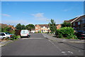
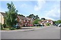
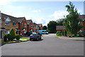
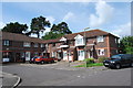
Images taken near to St. Faiths Close, PO12 3PP and the surrounding area
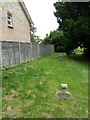
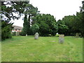
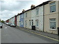
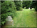
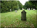
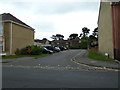
Please click the More button for more images, licensing and image copyright information.
Police
This area is policed by Hampshire Constabulary.
Hampshire Constabulary split their policing area into 95 separate neighbourhoods and this postcode is in the Gosport Central neighbourhood.

Gosport Central Neighbourhood Crime
Top 3 Categories
For full details of all categories together with more crime information, click on the Details button.
Member of UK Parliament
This postcode is in the Gosport parliamentary constituency.
Gosport is a constituency in the South East region of England. The seat has been held by Dame Caroline Dinenage (Conservative) since May 2010.

Most Recent House Sales for St. Faiths Close, PO12 3PP
16 Jun 2023
11 Nov 2022
28 Feb 2022
26 Jul 2021
Local Petrol Station Prices
Coordinates for PO12 3PP
Residents at PO12 3PP
Sunrise and Sunset at PO12 3PP
Traffic Emission and Congestion Zones
Historical Weather Summary
| Clear | 20.80% |
| Cloudy | 48.20% |
| Rain | 7.27% |
| Windy | 23.43% |
| Other | 0.30% |
Population
Deprivation Index
the more deprived the postcode
Average Energy Performance
Companies Registered at PO12 3PP
Postcode Details for PO12 3PP
Recent Updates
|
18 Apr 2024 Added Traffic Camera Views from Traffic Scotland to Roadworks within Scotland |
|
15 Apr 2024 Schools Data updated for April 2024 |
|
10 Apr 2024 Companies Data updated for March 2024 |
|
7 Apr 2024 New option to receive automatic updates to roadworks that affect you |
|
7 Apr 2024 Police and Crime data updated for February 2024 |
|
3 Apr 2024 Sold House Price data updated for February 2024 |
|
30 Mar 2024 Energy Performance Certificates (England and Wales) updated February 2024 |
|
28 Mar 2024 New feature to use Geolocating functions to detect your current location |
Random Postcodes
Want an idea of what is in our extensive website? Try somewhere completely random!
The Rural/Urban classification is based upon data collected during the 2011 Census and released in August 2013 and is categorised into 6 distinct classes.
[A] Urban Major conurbation: A built up area with a population of 10,000 (3,000 in Scotland) or more and is assigned to the major conurbation settlement category.
[B] Urban Minor conurbation: A built up area with a population of 10,000 (3,000 in Scotland) or more and is assigned to the minor conurbation settlement category.
[C] Urban City and town: A built up area with a population of 10,000 (3,000 in Scotland) or more and is assigned to the city and town settlement category.
[D] Rural Town and fringe
[E] Rural Village
[F] Rural Hamlet and isolated dwelling
The Index of Multiple Deprivation (IMD) is the official measure of relative deprivation.
The index is based on 39 separate indicators across seven distinct domains (Income; Employment; Health and Disability; Education, Skills and Training; Crime; Barriers to Housing and Services; Living Environment) to provide an overall measure of multiple deprivation and is calculated for every neighbourhood.
The index is relative rather than an absolute scale and so a neighbourhood with a score of 10 is more deprived than one rated 20, but this does not equate to being twice as deprived.
Please note: Different indices are used in England, Scotland, Wales and Northern Ireland and so comparison of scores from neighbourhoods in different countries should not be undertaken.
These figures report on incorporated UK companies only that are registered at this postcode and do not include sole-traders, partnerships or overseas organisations.
The population figure shown for your area are an estimate provided by the Office for National Statistics and is rounded to the nearest 1,000.
The estimates are derived from the Annual Population Survey (APS) which is the Labour Force Survey (LFS) plus various sample boosts.
There are 26 county councils in 2-tier areas, providing services such as education, social services and waste disposal.
In 2-tier areas, each county council area is subdivided into districts, for which there is an independent district council. There are 192 district councils.
District councils are responsible for local services such as rubbish collection, housing and planning applications.