Overview for Hempsals, ST. NEOTS, PE19 7QZ
Introduction
St Neots is a town in the Huntingdonshire district of Cambridgeshire, England. It is 18 miles (29 km) west of Cambridge. The areas of Eynesbury, Eaton Ford and Eaton Socon form part of the town.
The town is close to the A1 road (north-south) the A421 / A428 roads which link Cambridge to Bedford and Milton Keynes and is on the banks of the River Great Ouse which runs through the town.
St Neots had a population of 36,110 (forecast 2021 population) and the town is named after the ninth century monk Saint Neot, whose bones were brought to St Neots Priory from Cornwall in around 980 AD, resulting in pilgrims visiting in large numbers. Previously the whole town had been called Eynesbury, but the fame of Neot's relics led to that part of the town being called St Neots. In more recent times the town name St Neots is understood to encompass the whole community.
Summary for Hempsals, ST. NEOTS, PE19 7QZ
Roadworks near PE19 7QZ
Road Safety near PE19 7QZ
Details of personal injury accidents in and around Hempsals, PE19 7QZ that have been reported to Cambridgeshire Constabulary over the past 20 years.
Traffic Levels near PE19 7QZ
View traffic levels near Hempsals, PE19 7QZ from official Department for Transport counts.
Images taken near to Hempsals, PE19 7QZ and the surrounding area
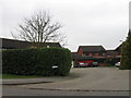
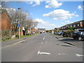
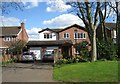
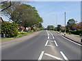
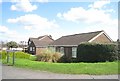
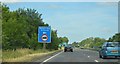
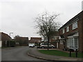

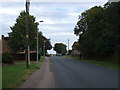
Please click the More button for more images, licensing and image copyright information.
Police
This area is policed by Cambridgeshire Constabulary.
Cambridgeshire Constabulary split their policing area into 14 separate neighbourhoods and this postcode is in the St Neots neighbourhood.

St Neots Neighbourhood Crime
Top 3 Categories
For full details of all categories together with more crime information, click on the Details button.
Member of UK Parliament
This postcode is in the Huntingdon parliamentary constituency.
Huntingdon is a constituency in the East of England region of England. The seat has been held by Mr Jonathan Djanogly (Conservative) since May 2010.

Most Recent House Sales for Hempsals, PE19 7QZ
25 Feb 2022
23 Jun 2016
22 Jun 2011
12 Dec 2008
Local Petrol Station Prices
Coordinates for PE19 7QZ
Residents at PE19 7QZ
Sunrise and Sunset at PE19 7QZ
Traffic Emission and Congestion Zones
Historical Weather Summary
| Clear | 22.35% |
| Cloudy | 63.81% |
| Rain | 5.92% |
| Windy | 7.84% |
| Other | 0.08% |
Population
Deprivation Index
the more deprived the postcode
Average Energy Performance
Companies Registered at PE19 7QZ
Postcode Details for PE19 7QZ
Recent Updates
|
18 Apr 2024 Added Traffic Camera Views from Traffic Scotland to Roadworks within Scotland |
|
15 Apr 2024 Schools Data updated for April 2024 |
|
10 Apr 2024 Companies Data updated for March 2024 |
|
7 Apr 2024 New option to receive automatic updates to roadworks that affect you |
|
7 Apr 2024 Police and Crime data updated for February 2024 |
|
3 Apr 2024 Sold House Price data updated for February 2024 |
|
30 Mar 2024 Energy Performance Certificates (England and Wales) updated February 2024 |
|
28 Mar 2024 New feature to use Geolocating functions to detect your current location |
Random Postcodes
Want an idea of what is in our extensive website? Try somewhere completely random!
The Rural/Urban classification is based upon data collected during the 2011 Census and released in August 2013 and is categorised into 6 distinct classes.
[A] Urban Major conurbation: A built up area with a population of 10,000 (3,000 in Scotland) or more and is assigned to the major conurbation settlement category.
[B] Urban Minor conurbation: A built up area with a population of 10,000 (3,000 in Scotland) or more and is assigned to the minor conurbation settlement category.
[C] Urban City and town: A built up area with a population of 10,000 (3,000 in Scotland) or more and is assigned to the city and town settlement category.
[D] Rural Town and fringe
[E] Rural Village
[F] Rural Hamlet and isolated dwelling
The Index of Multiple Deprivation (IMD) is the official measure of relative deprivation.
The index is based on 39 separate indicators across seven distinct domains (Income; Employment; Health and Disability; Education, Skills and Training; Crime; Barriers to Housing and Services; Living Environment) to provide an overall measure of multiple deprivation and is calculated for every neighbourhood.
The index is relative rather than an absolute scale and so a neighbourhood with a score of 10 is more deprived than one rated 20, but this does not equate to being twice as deprived.
Please note: Different indices are used in England, Scotland, Wales and Northern Ireland and so comparison of scores from neighbourhoods in different countries should not be undertaken.
These figures report on incorporated UK companies only that are registered at this postcode and do not include sole-traders, partnerships or overseas organisations.
The population figure shown for your area are an estimate provided by the Office for National Statistics and is rounded to the nearest 1,000.
The estimates are derived from the Annual Population Survey (APS) which is the Labour Force Survey (LFS) plus various sample boosts.
There are 26 county councils in 2-tier areas, providing services such as education, social services and waste disposal.
In 2-tier areas, each county council area is subdivided into districts, for which there is an independent district council. There are 192 district councils.
District councils are responsible for local services such as rubbish collection, housing and planning applications.