Overview for Glasgow Road, PAISLEY, PA1 3DR
Introduction
Paisley is a large town situated in the west central Lowlands of Scotland. Located north of the Gleniffer Braes, the town borders the city of Glasgow to the east, and straddles the banks of the White Cart Water, a tributary of the River Clyde.
Paisley serves as the administrative centre for the Renfrewshire council area, and is the largest town in the historic county of the same name. It is often cited as "Scotland's largest town" and is the fifth largest settlement in the country, although it does not have city status.
The town became prominent in the 12th century, with the establishment of Paisley Abbey, an important religious hub which formerly had control over other local churches.
By the 19th century, Paisley was a centre of the weaving industry, giving its name to the Paisley shawl and the Paisley pattern. The town's associations with political radicalism were highlighted by its involvement in the Radical War of 1820, with striking weavers being instrumental in the protests. By 1993, all of Paisley's mills had closed, although they are memorialised in the town's museums and civic history.
Summary for Glasgow Road, PAISLEY, PA1 3DR
Roadworks near PA1 3DR
Road Safety near PA1 3DR
Details of personal injury accidents in and around Glasgow Road, PA1 3DR that have been reported to over the past 20 years.
Traffic Levels near PA1 3DR
View traffic levels near Glasgow Road, PA1 3DR from official Department for Transport counts.
Images taken near to Glasgow Road, PA1 3DR and the surrounding area
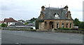
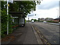
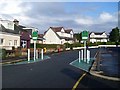
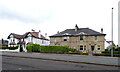
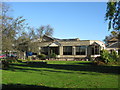
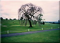
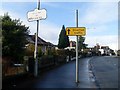
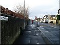
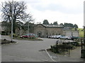
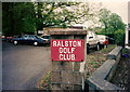
Please click the More button for more images, licensing and image copyright information.
Member of UK Parliament
This postcode is in the Paisley and Renfrewshire North parliamentary constituency.
Paisley and Renfrewshire North is a constituency in Scotland. The seat has been held by Gavin Newlands (Scottish National Party) since May 2015.

Most Recent House Sales for Glasgow Road, PA1 3DR
No recorded house sales or transfers for this postcode.
Local Petrol Station Prices
Coordinates for PA1 3DR
Sunrise and Sunset at PA1 3DR
Traffic Emission and Congestion Zones
Historical Weather Summary
| Clear | 6.96% |
| Cloudy | 63.00% |
| Rain | 14.29% |
| Windy | 15.13% |
| Other | 0.62% |
Average Energy Performance
Companies Registered at PA1 3DR
Postcode Details for PA1 3DR
Recent Updates
|
18 Apr 2024 Added Traffic Camera Views from Traffic Scotland to Roadworks within Scotland |
|
15 Apr 2024 Schools Data updated for April 2024 |
|
10 Apr 2024 Companies Data updated for March 2024 |
|
7 Apr 2024 New option to receive automatic updates to roadworks that affect you |
|
7 Apr 2024 Police and Crime data updated for February 2024 |
|
3 Apr 2024 Sold House Price data updated for February 2024 |
|
30 Mar 2024 Energy Performance Certificates (England and Wales) updated February 2024 |
|
28 Mar 2024 New feature to use Geolocating functions to detect your current location |
Random Postcodes
Want an idea of what is in our extensive website? Try somewhere completely random!
The Rural/Urban classification is based upon data collected during the 2011 Census and released in August 2013 and is categorised into 6 distinct classes.
[A] Urban Major conurbation: A built up area with a population of 10,000 (3,000 in Scotland) or more and is assigned to the major conurbation settlement category.
[B] Urban Minor conurbation: A built up area with a population of 10,000 (3,000 in Scotland) or more and is assigned to the minor conurbation settlement category.
[C] Urban City and town: A built up area with a population of 10,000 (3,000 in Scotland) or more and is assigned to the city and town settlement category.
[D] Rural Town and fringe
[E] Rural Village
[F] Rural Hamlet and isolated dwelling
The Index of Multiple Deprivation (IMD) is the official measure of relative deprivation.
The index is based on 39 separate indicators across seven distinct domains (Income; Employment; Health and Disability; Education, Skills and Training; Crime; Barriers to Housing and Services; Living Environment) to provide an overall measure of multiple deprivation and is calculated for every neighbourhood.
The index is relative rather than an absolute scale and so a neighbourhood with a score of 10 is more deprived than one rated 20, but this does not equate to being twice as deprived.
Please note: Different indices are used in England, Scotland, Wales and Northern Ireland and so comparison of scores from neighbourhoods in different countries should not be undertaken.
These figures report on incorporated UK companies only that are registered at this postcode and do not include sole-traders, partnerships or overseas organisations.
The population figure shown for your area are an estimate provided by the Office for National Statistics and is rounded to the nearest 1,000.
The estimates are derived from the Annual Population Survey (APS) which is the Labour Force Survey (LFS) plus various sample boosts.
There are 55 unitary authorities. They provide all local government services in their areas. These are mainly in the cities, urban areas and larger towns although there are now 6 shire county councils that are unitary (ie have no district councils beneath them).