Overview for Main Street, NOTTINGHAM, NG6 8QJ
Introduction
Nottingham is a city and unitary authority area in Nottinghamshire, East Midlands, England. It is located 110 miles (180 km) north-west of London, 33 miles (53 km) south-east of Sheffield and 45 miles (72 km) north-east of Birmingham. Nottingham has links to the legend of Robin Hood and to the lace-making, bicycle and tobacco industries. The city is also the county town of Nottinghamshire and the settlement was granted its city charter in 1897, as part of Queen Victoria's Diamond Jubilee celebrations. Nottingham is a tourist destination; in 2018, the city received the second-highest number of overnight visitors in the Midlands and the highest number in the East Midlands.
In the Census 2021 results, Nottingham had a reported population of 323,632. The wider conurbation, which includes many of the city's suburbs, has a population of 768,638. It is the largest urban area in the East Midlands and the second-largest in the Midlands. Its Functional Urban Area, the largest in the East Midlands, has a population of 919,484. The population of the Nottingham/Derby metropolitan area is estimated to be 1,610,000. The metropolitan economy of Nottingham is the seventh-largest in the United Kingdom with a GDP of $50.9 billion (2014). Aside from Birmingham, it is the only city in the Midlands to be ranked as a sufficiency-level world city by the Globalization and World Cities Research Network.
Nottingham is a major sporting centre and, in October 2015, was named 'Home of English Sport'. The National Ice Centre, Holme Pierrepont National Watersports Centre and Trent Bridge international cricket ground are all based in or around the city, which is also the home of two professional football teams: Notts County, recognised as the world's oldest professional league club, and Nottingham Forest, famously two-time winners of the UEFA European Cup under Brian Clough and Peter Taylor in 1979 and 1980. The city has professional rugby, ice hockey and cricket teams; it also hosts the Aegon Nottingham Open, an international tennis tournament on the ATP and WTA tours. This accolade came just over a year after Nottingham was named as the UK's first City of Football.
The city is served by Nottingham railway station and the Nottingham Express Transit tram system; its bus company, Nottingham City Transport, is the largest publicly owned bus network in England. In December 2015, Nottingham was named a 'City of Literature' by UNESCO, joining a list of 20 Cities of Literature. The title reflects Nottingham's literary heritage, with Lord Byron, D. H. Lawrence and Alan Sillitoe having links to the city, as well as a contemporary literary community, a publishing industry and a poetry scene. The city is served by three universities: the University of Nottingham, Nottingham Trent University and the Nottingham campus of the University of Law; it hosts the highest concentration of higher education providers in the East Midlands.
Summary for Main Street, NOTTINGHAM, NG6 8QJ
Roadworks near NG6 8QJ
Road Safety near NG6 8QJ
Details of personal injury accidents in and around Main Street, NG6 8QJ that have been reported to Nottinghamshire Police over the past 20 years.
Traffic Levels near NG6 8QJ
View traffic levels near Main Street, NG6 8QJ from official Department for Transport counts.
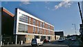
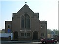
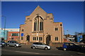
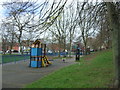
Images taken near to Main Street, NG6 8QJ and the surrounding area
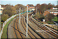
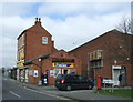
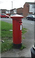
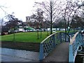
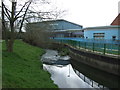
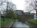
Please click the More button for more images, licensing and image copyright information.
Nottingham and nearby Videos From YouTube
Shipley Park and Beyond 2022 Drone Cam
September 2022 drone footage of part of Shipley park looking south over the old American Adventure site (now building site) and ...
Channel: Paul Mills (View Channel)
Published: 17 Sep 2022
Member of UK Parliament
This postcode is in the Nottingham North parliamentary constituency.
Nottingham North is a constituency in the East Midlands region of England. The seat has been held by Alex Norris (Labour) since June 2017.

Most Recent House Sales for Main Street, NG6 8QJ
No recorded house sales or transfers for this postcode.
Local Petrol Station Prices
Coordinates for NG6 8QJ
Residents at NG6 8QJ
Sunrise and Sunset at NG6 8QJ
Traffic Emission and Congestion Zones
Historical Weather Summary
| Clear | 9.60% |
| Cloudy | 72.10% |
| Rain | 7.70% |
| Windy | 10.44% |
| Other | 0.16% |
Population
Deprivation Index
the more deprived the postcode
Companies Registered at NG6 8QJ
Postcode Details for NG6 8QJ
Recent Updates
|
18 Apr 2024 Added Traffic Camera Views from Traffic Scotland to Roadworks within Scotland |
|
15 Apr 2024 Schools Data updated for April 2024 |
|
10 Apr 2024 Companies Data updated for March 2024 |
|
7 Apr 2024 New option to receive automatic updates to roadworks that affect you |
|
7 Apr 2024 Police and Crime data updated for February 2024 |
|
3 Apr 2024 Sold House Price data updated for February 2024 |
|
30 Mar 2024 Energy Performance Certificates (England and Wales) updated February 2024 |
|
28 Mar 2024 New feature to use Geolocating functions to detect your current location |
Random Postcodes
Want an idea of what is in our extensive website? Try somewhere completely random!
The Rural/Urban classification is based upon data collected during the 2011 Census and released in August 2013 and is categorised into 6 distinct classes.
[A] Urban Major conurbation: A built up area with a population of 10,000 (3,000 in Scotland) or more and is assigned to the major conurbation settlement category.
[B] Urban Minor conurbation: A built up area with a population of 10,000 (3,000 in Scotland) or more and is assigned to the minor conurbation settlement category.
[C] Urban City and town: A built up area with a population of 10,000 (3,000 in Scotland) or more and is assigned to the city and town settlement category.
[D] Rural Town and fringe
[E] Rural Village
[F] Rural Hamlet and isolated dwelling
The Index of Multiple Deprivation (IMD) is the official measure of relative deprivation.
The index is based on 39 separate indicators across seven distinct domains (Income; Employment; Health and Disability; Education, Skills and Training; Crime; Barriers to Housing and Services; Living Environment) to provide an overall measure of multiple deprivation and is calculated for every neighbourhood.
The index is relative rather than an absolute scale and so a neighbourhood with a score of 10 is more deprived than one rated 20, but this does not equate to being twice as deprived.
Please note: Different indices are used in England, Scotland, Wales and Northern Ireland and so comparison of scores from neighbourhoods in different countries should not be undertaken.
These figures report on incorporated UK companies only that are registered at this postcode and do not include sole-traders, partnerships or overseas organisations.
The population figure shown for your area are an estimate provided by the Office for National Statistics and is rounded to the nearest 1,000.
The estimates are derived from the Annual Population Survey (APS) which is the Labour Force Survey (LFS) plus various sample boosts.
Large User Postcode
This postcode is designated a large user postcode. A large user postcode is assigned by Royal Mail to those organisations typically receiving at least 500 mail items per day and so will usually be found assigned to business premises.
There are 55 unitary authorities. They provide all local government services in their areas. These are mainly in the cities, urban areas and larger towns although there are now 6 shire county councils that are unitary (ie have no district councils beneath them).