Overview for Addington Drive, BLYTH, NE24 3TH
Introduction
Blyth is a town and civil parish in southeast Northumberland, England. It lies on the coast, to the south of the River Blyth and is approximately 13 miles (21 km) northeast of Newcastle upon Tyne. It had a population of 37,339 in the 2011 Census.
The port of Blyth dates from the 12th century, but the development of the modern town only began in the first quarter of the 18th century. The main industries which helped the town prosper were coal mining and shipbuilding, with the salt trade, fishing and the railways also playing an important role. These industries have largely vanished, but the port still thrives, receiving paper and pulp from Scandinavia for the newspaper industries of England and Scotland.
The town was seriously affected when its principal industries went into decline, and it has undergone much regeneration since the early 1990s. The Keel Row Shopping Centre, opened in 1991, brought major high street retailers to Blyth, and helped to revitalise the town centre. The market place has recently been re-developed, with the aim of attracting further investment to the town.
The Quayside has also seen much redevelopment and has been transformed into a peaceful open space, the centrepiece of which is a sculpture commemorating the industry that once thrived there. On the opposite side of the river are the nine wind turbines of the Blyth Harbour Wind Farm, which were constructed along the East Pier in 1992. They were joined in 2000 by Blyth Offshore Wind Farm, which consisted of two turbines situated 1 kilometre (0.62 mi) out to sea. These were the first two offshore wind turbines in the UK. These wind turbines were all decommissioned, with the final two being removed in 2019. A new wind farm further off the coast, composed of five turbines, was commissioned in 2017.
Blyth is also home to the non-League football club Blyth Spartans, famed for their 1978 "giant-killing" feats in the FA Cup.
Summary for Addington Drive, BLYTH, NE24 3TH
Roadworks near NE24 3TH
Road Safety near NE24 3TH
Details of personal injury accidents in and around Addington Drive, NE24 3TH that have been reported to Northumbria Police over the past 20 years.
Traffic Levels near NE24 3TH
View traffic levels near Addington Drive, NE24 3TH from official Department for Transport counts.
Images taken near to Addington Drive, NE24 3TH and the surrounding area
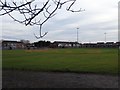
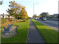
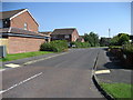
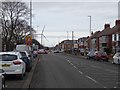
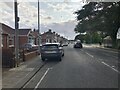
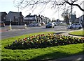
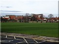
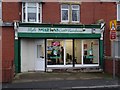
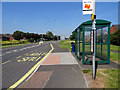
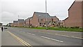
Please click the More button for more images, licensing and image copyright information.
Police
This area is policed by Northumbria Police.
Northumbria Police split their policing area into 35 separate neighbourhoods and this postcode is in the Blyth neighbourhood.

Blyth Neighbourhood Crime
Top 3 Categories
For full details of all categories together with more crime information, click on the Details button.
Member of UK Parliament
This postcode is in the Blyth Valley parliamentary constituency.
Blyth Valley is a constituency in the North East region of England. The seat has been held by Ian Levy (Conservative) since December 2019.

Most Recent House Sales for Addington Drive, NE24 3TH
30 Sep 2021
17 Apr 2020
22 Jun 2018
23 Mar 2018
Local Petrol Station Prices
Coordinates for NE24 3TH
Residents at NE24 3TH
Sunrise and Sunset at NE24 3TH
Traffic Emission and Congestion Zones
Historical Weather Summary
| Clear | 11.50% |
| Cloudy | 58.83% |
| Rain | 9.25% |
| Windy | 20.42% |
| Other | 0.00% |
Population
Deprivation Index
the more deprived the postcode
Average Energy Performance
Companies Registered at NE24 3TH
Postcode Details for NE24 3TH
Recent Updates
|
18 Apr 2024 Added Traffic Camera Views from Traffic Scotland to Roadworks within Scotland |
|
15 Apr 2024 Schools Data updated for April 2024 |
|
10 Apr 2024 Companies Data updated for March 2024 |
|
7 Apr 2024 New option to receive automatic updates to roadworks that affect you |
|
7 Apr 2024 Police and Crime data updated for February 2024 |
|
3 Apr 2024 Sold House Price data updated for February 2024 |
|
30 Mar 2024 Energy Performance Certificates (England and Wales) updated February 2024 |
|
28 Mar 2024 New feature to use Geolocating functions to detect your current location |
Random Postcodes
Want an idea of what is in our extensive website? Try somewhere completely random!
The Rural/Urban classification is based upon data collected during the 2011 Census and released in August 2013 and is categorised into 6 distinct classes.
[A] Urban Major conurbation: A built up area with a population of 10,000 (3,000 in Scotland) or more and is assigned to the major conurbation settlement category.
[B] Urban Minor conurbation: A built up area with a population of 10,000 (3,000 in Scotland) or more and is assigned to the minor conurbation settlement category.
[C] Urban City and town: A built up area with a population of 10,000 (3,000 in Scotland) or more and is assigned to the city and town settlement category.
[D] Rural Town and fringe
[E] Rural Village
[F] Rural Hamlet and isolated dwelling
The Index of Multiple Deprivation (IMD) is the official measure of relative deprivation.
The index is based on 39 separate indicators across seven distinct domains (Income; Employment; Health and Disability; Education, Skills and Training; Crime; Barriers to Housing and Services; Living Environment) to provide an overall measure of multiple deprivation and is calculated for every neighbourhood.
The index is relative rather than an absolute scale and so a neighbourhood with a score of 10 is more deprived than one rated 20, but this does not equate to being twice as deprived.
Please note: Different indices are used in England, Scotland, Wales and Northern Ireland and so comparison of scores from neighbourhoods in different countries should not be undertaken.
These figures report on incorporated UK companies only that are registered at this postcode and do not include sole-traders, partnerships or overseas organisations.
The population figure shown for your area are an estimate provided by the Office for National Statistics and is rounded to the nearest 1,000.
The estimates are derived from the Annual Population Survey (APS) which is the Labour Force Survey (LFS) plus various sample boosts.
There are 55 unitary authorities. They provide all local government services in their areas. These are mainly in the cities, urban areas and larger towns although there are now 6 shire county councils that are unitary (ie have no district councils beneath them).