Overview for Mangold Road, LEICESTER, LE4 2AY
Introduction
Leicester (LES-tər) is a city, unitary authority area, unparished area and the county town of Leicestershire in the East Midlands of England. It is the largest city in the East Midlands. Its population was 368,600 in 2021, increased by 38,800 (11.8%) from around 329,800 in 2011. The greater Leicester urban area had a population of 559,017 in 2021, making it the 11th most populous in England, and the 13th most populous in the United Kingdom.
The city lies on the River Soar and is approximately 90 miles (140 km) north-northwest of London, 33 miles (53 km) east-northeast of Birmingham and 21 miles (34 km) northeast of Coventry. Nottingham and Derby lie around 21 miles to the north and northwest respectively, whilst Peterborough is located 37 miles (60 km) to the east. Leicester is close to the eastern end of the National Forest.
Leicester has a long history extending into ancient times, it was the site of the Roman town of Ratae Corieltauvorum, which was later captured by the Anglo-Saxons, and then by the Vikings who made it one of the Five Boroughs of the Danelaw. Leicester became an important town during the Middle Ages, and then an important industrial and commercial centre in the Victorian age, eventually gaining city status in 1919. Since the mid-20th century, immigration from countries of the British Commonwealth has seen Leicester become an ethnically diverse city, and one of the largest urban centres of the Midlands.
Leicester is at the intersection of two railway lines: the Midland Main Line and the Birmingham to London Stansted Airport line. It is also at the confluence of the M1/M69 motorways and the A6/A46 trunk routes. Leicester Cathedral is home to the tomb of King Richard III who was reburied in the cathedral in 2015 after being discovered nearby in the foundations of the lost Greyfriars chapel, more than 500 years after his death. In sporting terms, Leicester is the home to football club Leicester City and rugby club Leicester Tigers.
Summary for Mangold Road, LEICESTER, LE4 2AY
Roadworks near LE4 2AY
Road Safety near LE4 2AY
Details of personal injury accidents in and around Mangold Road, LE4 2AY that have been reported to Leicestershire Police over the past 20 years.
Traffic Levels near LE4 2AY
View traffic levels near Mangold Road, LE4 2AY from official Department for Transport counts.
Images taken near to Mangold Road, LE4 2AY and the surrounding area
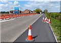
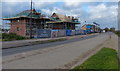
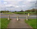
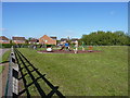
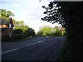
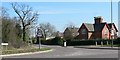
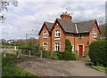
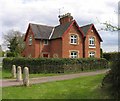
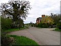
Please click the More button for more images, licensing and image copyright information.
Leicester and nearby Videos From YouTube
Drone View of Countesthorpe Gardens and Allotment Society
Footage of the Countesthorpe Gardens and Allotment Society taken by Drone pilot Tony Postlethwaite.
Channel: Countesthorpe Gardens and Allotment Society (View Channel)
Published: 26 Sep 2021
Police
This area is policed by Leicestershire Police.
Leicestershire Police split their policing area into 67 separate neighbourhoods and this postcode is in the Beaumont Leys neighbourhood.

Beaumont Leys Neighbourhood Crime
Top 3 Categories
For full details of all categories together with more crime information, click on the Details button.
Member of UK Parliament
This postcode is in the Leicester West parliamentary constituency.
Leicester West is a constituency in the East Midlands region of England. The seat has been held by Liz Kendall (Labour) since May 2010.

Most Recent House Sales for Mangold Road, LE4 2AY
9 Feb 2023
14 Nov 2022
15 Jul 2022
28 Feb 2020
Local Petrol Station Prices
Coordinates for LE4 2AY
Residents at LE4 2AY
Sunrise and Sunset at LE4 2AY
Traffic Emission and Congestion Zones
Historical Weather Summary
| Clear | 18.90% |
| Cloudy | 58.99% |
| Rain | 6.56% |
| Windy | 15.40% |
| Other | 0.15% |
Population
Deprivation Index
the more deprived the postcode
Average Energy Performance
Companies Registered at LE4 2AY
Postcode Details for LE4 2AY
Recent Updates
|
18 Apr 2024 Added Traffic Camera Views from Traffic Scotland to Roadworks within Scotland |
|
15 Apr 2024 Schools Data updated for April 2024 |
|
10 Apr 2024 Companies Data updated for March 2024 |
|
7 Apr 2024 New option to receive automatic updates to roadworks that affect you |
|
7 Apr 2024 Police and Crime data updated for February 2024 |
|
3 Apr 2024 Sold House Price data updated for February 2024 |
|
30 Mar 2024 Energy Performance Certificates (England and Wales) updated February 2024 |
|
28 Mar 2024 New feature to use Geolocating functions to detect your current location |
Random Postcodes
Want an idea of what is in our extensive website? Try somewhere completely random!
The Rural/Urban classification is based upon data collected during the 2011 Census and released in August 2013 and is categorised into 6 distinct classes.
[A] Urban Major conurbation: A built up area with a population of 10,000 (3,000 in Scotland) or more and is assigned to the major conurbation settlement category.
[B] Urban Minor conurbation: A built up area with a population of 10,000 (3,000 in Scotland) or more and is assigned to the minor conurbation settlement category.
[C] Urban City and town: A built up area with a population of 10,000 (3,000 in Scotland) or more and is assigned to the city and town settlement category.
[D] Rural Town and fringe
[E] Rural Village
[F] Rural Hamlet and isolated dwelling
The Index of Multiple Deprivation (IMD) is the official measure of relative deprivation.
The index is based on 39 separate indicators across seven distinct domains (Income; Employment; Health and Disability; Education, Skills and Training; Crime; Barriers to Housing and Services; Living Environment) to provide an overall measure of multiple deprivation and is calculated for every neighbourhood.
The index is relative rather than an absolute scale and so a neighbourhood with a score of 10 is more deprived than one rated 20, but this does not equate to being twice as deprived.
Please note: Different indices are used in England, Scotland, Wales and Northern Ireland and so comparison of scores from neighbourhoods in different countries should not be undertaken.
These figures report on incorporated UK companies only that are registered at this postcode and do not include sole-traders, partnerships or overseas organisations.
The population figure shown for your area are an estimate provided by the Office for National Statistics and is rounded to the nearest 1,000.
The estimates are derived from the Annual Population Survey (APS) which is the Labour Force Survey (LFS) plus various sample boosts.
There are 55 unitary authorities. They provide all local government services in their areas. These are mainly in the cities, urban areas and larger towns although there are now 6 shire county councils that are unitary (ie have no district councils beneath them).