Overview for St. William Way, LIVERPOOL, L23 9XD
Introduction
Liverpool is a city and metropolitan borough in Merseyside, North West England, with a population of 500,500 in 2022. The city is part of a broader metropolitan area that is the fifth largest in the United Kingdom, with a population of 2.24 million. A historic port city, Liverpool lies on the eastern side of the Mersey Estuary adjacent to the Irish Sea. The city was an important part of the Industrial Revolution in Great Britain and a vital hub for trade. The city celebrated its 800th anniversary in 2007 and was named the 2008 European Capital of Culture. Its selection was credited with kickstarting an economic renaissance in the region.
Liverpool is within the boundaries of the ancient hundred of West Derby in the historic county of Lancashire. It was made a borough in 1207, and was made a city in 1880, and a county borough independent of the newly-created Lancashire County Council in 1889. Its growth as a major port was paralleled by the expansion of the city throughout the Industrial Revolution. Along with general cargo, freight, and raw materials such as coal and cotton, merchants were involved in the slave trade. In the 19th century, Liverpool was a major port of departure for English and Irish emigrants to North America. It was also home to both the Cunard and White Star Lines, and was the port of registry of the ocean liners RMS Titanic, RMS Lusitania, RMS Queen Mary, RMS Queen Elizabeth and RMS Olympic.
Liverpool has the second highest number of art galleries, national museums, listed buildings, and listed parks in the UK; only the capital, London, has more. The former Liverpool Maritime Mercantile City includes the Pier Head, Royal Albert Dock and William Brown Street. Several areas of Liverpool city centre carried World Heritage Site status from 2004 until 2021; the city's vast collection of parks and open spaces has been described as the "most important in the country" by England's Register of Historic Parks and Gardens of Special Historic Interest. In 2019, Liverpool was the fifth most visited UK city. It is noted for its culture, architecture, and transport links.
The city is closely associated with sport and the arts, especially music. In sports the city is best known as the home of Premier League football teams Liverpool F.
C. and Everton F.
C., with matches between the two rivals being known as the Merseyside derby. The annual Grand National horse race takes place at Aintree Racecourse. The significance of Liverpool to pop music is linked intrinsically to the popularity and success of the Beatles, widely regarded as the most influential band of all time. Liverpool has continued to produce notable musicians. Musicians from the city have released 56 No. 1 hit singles, more than any other city in the world. The city also has a long-standing reputation for producing actors and actresses, artists, athletes, comedians, journalists, novelists, and poets.
Natives of Liverpool (and some longtime residents from elsewhere) are formally referred to as "Liverpudlians" but are usually called "Scousers" in reference to scouse, a local stew made popular by sailors in the city; "Scouse" is also the most common name for the Liverpool accent and dialect. Its status as a port city historically attracted a diverse population from a wide range of cultures, primarily Ireland, Norway, and Wales. It is also home to the oldest black community in the UK and the oldest Chinese community in Europe.
Summary for St. William Way, LIVERPOOL, L23 9XD
Roadworks near L23 9XD
Road Safety near L23 9XD
Details of personal injury accidents in and around St. William Way, L23 9XD that have been reported to Merseyside Police over the past 20 years.
Traffic Levels near L23 9XD
View traffic levels near St. William Way, L23 9XD from official Department for Transport counts.
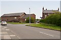
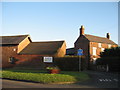
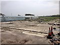
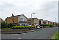
Images taken near to St. William Way, L23 9XD and the surrounding area
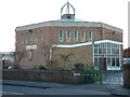
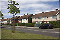

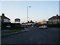
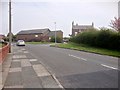

Please click the More button for more images, licensing and image copyright information.
Liverpool and nearby Videos From YouTube
#Snow #Liverpool 10/12/22 #HDR Drone Footage
Snow #Liverpool 10/12/22 #HDR.
Channel: The Way I See Liverpool (View Channel)
Published: 10 Dec 2022
Police
This area is policed by Merseyside Police.
Merseyside Police split their policing area into 139 separate neighbourhoods and this postcode is in the Manor neighbourhood.

Manor Neighbourhood Crime
Top 3 Categories
For full details of all categories together with more crime information, click on the Details button.
Member of UK Parliament
This postcode is in the Sefton Central parliamentary constituency.
Sefton Central is a constituency in the North West region of England. The seat has been held by Bill Esterson (Labour) since May 2010.

Most Recent House Sales for St. William Way, L23 9XD
6 Dec 2019
26 Feb 2014
1 Aug 2003
30 Apr 1997
Local Petrol Station Prices
Coordinates for L23 9XD
Residents at L23 9XD
Sunrise and Sunset at L23 9XD
Traffic Emission and Congestion Zones
Historical Weather Summary
| Clear | 18.08% |
| Cloudy | 59.95% |
| Rain | 7.54% |
| Windy | 14.38% |
| Other | 0.05% |
Population
Deprivation Index
the more deprived the postcode
Average Energy Performance
Companies Registered at L23 9XD
Postcode Details for L23 9XD
Recent Updates
|
18 Apr 2024 Added Traffic Camera Views from Traffic Scotland to Roadworks within Scotland |
|
15 Apr 2024 Schools Data updated for April 2024 |
|
10 Apr 2024 Companies Data updated for March 2024 |
|
7 Apr 2024 New option to receive automatic updates to roadworks that affect you |
|
7 Apr 2024 Police and Crime data updated for February 2024 |
|
3 Apr 2024 Sold House Price data updated for February 2024 |
|
30 Mar 2024 Energy Performance Certificates (England and Wales) updated February 2024 |
|
28 Mar 2024 New feature to use Geolocating functions to detect your current location |
Random Postcodes
Want an idea of what is in our extensive website? Try somewhere completely random!
The Rural/Urban classification is based upon data collected during the 2011 Census and released in August 2013 and is categorised into 6 distinct classes.
[A] Urban Major conurbation: A built up area with a population of 10,000 (3,000 in Scotland) or more and is assigned to the major conurbation settlement category.
[B] Urban Minor conurbation: A built up area with a population of 10,000 (3,000 in Scotland) or more and is assigned to the minor conurbation settlement category.
[C] Urban City and town: A built up area with a population of 10,000 (3,000 in Scotland) or more and is assigned to the city and town settlement category.
[D] Rural Town and fringe
[E] Rural Village
[F] Rural Hamlet and isolated dwelling
The Index of Multiple Deprivation (IMD) is the official measure of relative deprivation.
The index is based on 39 separate indicators across seven distinct domains (Income; Employment; Health and Disability; Education, Skills and Training; Crime; Barriers to Housing and Services; Living Environment) to provide an overall measure of multiple deprivation and is calculated for every neighbourhood.
The index is relative rather than an absolute scale and so a neighbourhood with a score of 10 is more deprived than one rated 20, but this does not equate to being twice as deprived.
Please note: Different indices are used in England, Scotland, Wales and Northern Ireland and so comparison of scores from neighbourhoods in different countries should not be undertaken.
These figures report on incorporated UK companies only that are registered at this postcode and do not include sole-traders, partnerships or overseas organisations.
The population figure shown for your area are an estimate provided by the Office for National Statistics and is rounded to the nearest 1,000.
The estimates are derived from the Annual Population Survey (APS) which is the Labour Force Survey (LFS) plus various sample boosts.
There are 36 metropolitan district councils which together cover 6 large urban areas: the counties of Greater Manchester, Merseyside, South Yorkshire, Tyne and Wear, West Midlands, and West Yorkshire.
Metropolitan districts are responsible for all services in their area, although certain conurbation wide services such as fire and civil defence, police, waste disposal and passenger transport are provided through joint authorities (the districts acting jointly).