Overview for Birkfield Drive, IPSWICH, IP2 9JD
Introduction
Ipswich is a town and borough in the county of Suffolk, England. Ipswich is the county town of Suffolk and is the largest settlement in the county, followed by Lowestoft and Bury St Edmunds. It is situated in East Anglia. Ipswich is the second-largest population centre in East Anglia, Norwich being the largest. It is 67 miles (108 km) northeast of London. The Ipswich built-up area is the fourth-largest in the East of England region and the 42nd-largest in England and Wales. It includes the towns and villages of Kesgrave, Woodbridge, Bramford and Martlesham Heath.
Ipswich was first recorded during the medieval period as Gippeswic, the town has also been recorded as Gyppewicus and Yppswyche. It has been continuously inhabited since the Saxon period, and is believed to be one of the oldest towns in the United Kingdom. The settlement was of great economic importance to the Kingdom of England throughout its history, particularly in trade, with the town's historical dock, Ipswich Waterfront, known as the largest and most important dock in the Kingdom.
Ipswich is divided into various quarters, with the town centre and the waterfront drawing the most footfall. The town centre features the retail shopping district and the historic town square, known as the Cornhill. The waterfront, south of the town centre on a meander of the River Orwell, offers a picturesque setting with a marina, luxury yachts, high-rise apartment buildings, and a variety of restaurants and cafes. The waterfront is also home to the University of Suffolk campus.
Ipswich is surrounded by two Areas of Outstanding Natural Beauty (AONB): the Suffolk Coast and Heaths and Dedham Vale. The town has a tourist sector, with 3.5 million people reported to have visited the town in 2016. In 2020, Ipswich was ranked as an emerging global tourist destination by TripAdvisor.
Summary for Birkfield Drive, IPSWICH, IP2 9JD
Roadworks near IP2 9JD
Road Safety near IP2 9JD
Details of personal injury accidents in and around Birkfield Drive, IP2 9JD that have been reported to Suffolk Constabulary over the past 20 years.
Traffic Levels near IP2 9JD
View traffic levels near Birkfield Drive, IP2 9JD from official Department for Transport counts.
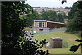
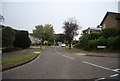
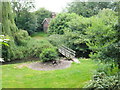
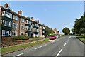
Images taken near to Birkfield Drive, IP2 9JD and the surrounding area

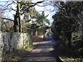

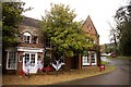
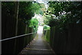
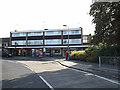
Please click the More button for more images, licensing and image copyright information.
Ipswich and nearby Videos From YouTube
Harwich, Essex - DJI Mini 3 Pro 4K Drone
I do not own this music Music is Among the clouds - Helmet Schenker All drone footage is taken by myself.
Channel: GameOfDrones (View Channel)
Published: 24 Oct 2022
Police
This area is policed by Suffolk Constabulary.
Suffolk Constabulary split their policing area into 50 separate neighbourhoods and this postcode is in the Ipswich West neighbourhood.

Ipswich West Neighbourhood Crime
Top 3 Categories
For full details of all categories together with more crime information, click on the Details button.
Member of UK Parliament
This postcode is in the Ipswich parliamentary constituency.
Ipswich is a constituency in the East of England region of England. The seat has been held by Tom Hunt (Conservative) since December 2019.

Most Recent House Sales for Birkfield Drive, IP2 9JD
7 Jun 2021
15 Feb 2021
3 Jul 2019
16 Sep 2016
Local Petrol Station Prices
Coordinates for IP2 9JD
Residents at IP2 9JD
Sunrise and Sunset at IP2 9JD
Traffic Emission and Congestion Zones
Historical Weather Summary
| Clear | 11.00% |
| Cloudy | 68.71% |
| Rain | 6.58% |
| Windy | 13.67% |
| Other | 0.04% |
Population
Deprivation Index
the more deprived the postcode
Average Energy Performance
Companies Registered at IP2 9JD
Postcode Details for IP2 9JD
Recent Updates
|
18 Apr 2024 Added Traffic Camera Views from Traffic Scotland to Roadworks within Scotland |
|
15 Apr 2024 Schools Data updated for April 2024 |
|
10 Apr 2024 Companies Data updated for March 2024 |
|
7 Apr 2024 New option to receive automatic updates to roadworks that affect you |
|
7 Apr 2024 Police and Crime data updated for February 2024 |
|
3 Apr 2024 Sold House Price data updated for February 2024 |
|
30 Mar 2024 Energy Performance Certificates (England and Wales) updated February 2024 |
|
28 Mar 2024 New feature to use Geolocating functions to detect your current location |
Random Postcodes
Want an idea of what is in our extensive website? Try somewhere completely random!
The Rural/Urban classification is based upon data collected during the 2011 Census and released in August 2013 and is categorised into 6 distinct classes.
[A] Urban Major conurbation: A built up area with a population of 10,000 (3,000 in Scotland) or more and is assigned to the major conurbation settlement category.
[B] Urban Minor conurbation: A built up area with a population of 10,000 (3,000 in Scotland) or more and is assigned to the minor conurbation settlement category.
[C] Urban City and town: A built up area with a population of 10,000 (3,000 in Scotland) or more and is assigned to the city and town settlement category.
[D] Rural Town and fringe
[E] Rural Village
[F] Rural Hamlet and isolated dwelling
The Index of Multiple Deprivation (IMD) is the official measure of relative deprivation.
The index is based on 39 separate indicators across seven distinct domains (Income; Employment; Health and Disability; Education, Skills and Training; Crime; Barriers to Housing and Services; Living Environment) to provide an overall measure of multiple deprivation and is calculated for every neighbourhood.
The index is relative rather than an absolute scale and so a neighbourhood with a score of 10 is more deprived than one rated 20, but this does not equate to being twice as deprived.
Please note: Different indices are used in England, Scotland, Wales and Northern Ireland and so comparison of scores from neighbourhoods in different countries should not be undertaken.
These figures report on incorporated UK companies only that are registered at this postcode and do not include sole-traders, partnerships or overseas organisations.
The population figure shown for your area are an estimate provided by the Office for National Statistics and is rounded to the nearest 1,000.
The estimates are derived from the Annual Population Survey (APS) which is the Labour Force Survey (LFS) plus various sample boosts.
There are 26 county councils in 2-tier areas, providing services such as education, social services and waste disposal.
In 2-tier areas, each county council area is subdivided into districts, for which there is an independent district council. There are 192 district councils.
District councils are responsible for local services such as rubbish collection, housing and planning applications.