Overview for Cumnor Crescent, EDINBURGH, EH16 6BD
Introduction
Edinburgh is the capital city of Scotland and one of its 32 council areas. The modern city is located between the rivers Almond and Esk on the southern shore of the Firth of Forth, in the historic region of Lothian, bounded on its southern side by the Pentland Hills. Edinburgh is Scotland's second most populous city and the seventh most populous city in the United Kingdom.
Recognised as the capital of Scotland since at least the 15th century, Edinburgh is the seat of the Scottish Government, the Scottish Parliament, and the highest courts in Scotland. The city's Palace of Holyroodhouse is the official residence of the British monarch in Scotland. The city has long been a centre of education, particularly in the fields of medicine, Scottish law, literature, philosophy, the sciences and engineering. It is the second-largest financial centre in the United Kingdom, fourth largest in Europe and thirteenth largest internationally and the city's historical and cultural attractions have made it the UK's second-most visited tourist destination, attracting 4.9 million visits, including 2.4 million from overseas in 2018. Time Out magazine rated Edinburgh the best city in the world in 2022.
Edinburgh's official population estimates are
506,520 (mid-2020) for the locality, 518,500 (mid-2019) for the City of Edinburgh council area, which takes in some outlying villages in the western part of its territory, and 1,384,950 (2019) for the wider Edinburgh and South East Scotland city region which also includes East Lothian, Fife, Midlothian, the Scottish Borders and West Lothian. The City of Edinburgh Council is the current local authority.
The city is the annual venue of the General Assembly of the Church of Scotland. It is home to national cultural institutions such as the National Museum of Scotland, the National Library of Scotland and the Scottish National Gallery. The University of Edinburgh, founded in 1582 and now one of three in the city, is considered one of the best research institutions in the world, most recently placing 15th in the QS World University Rankings for 2023. The city is also known for the Edinburgh International Festival and the Fringe, the latter being the world's largest annual international arts festival. Historic sites in Edinburgh include Edinburgh Castle, the Palace of Holyroodhouse, the churches of St. Giles, Greyfriars and the Canongate, and the extensive Georgian New Town built in the 18th/19th centuries. Edinburgh's Old Town and New Town together are listed as a UNESCO World Heritage Site, which has been managed by Edinburgh World Heritage since 1999.
Summary for Cumnor Crescent, EDINBURGH, EH16 6BD
Roadworks near EH16 6BD
Road Safety near EH16 6BD
Details of personal injury accidents in and around Cumnor Crescent, EH16 6BD that have been reported to over the past 20 years.
Traffic Levels near EH16 6BD
View traffic levels near Cumnor Crescent, EH16 6BD from official Department for Transport counts.
Images taken near to Cumnor Crescent, EH16 6BD and the surrounding area


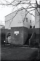
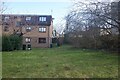
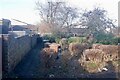
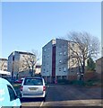
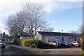
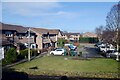
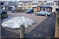

Please click the More button for more images, licensing and image copyright information.
Edinburgh and nearby Videos From YouTube
Penicuik House, Scotland. Drone aerial footage in HD 4K.
Penicuik House and Estate, Scotland. Video by DOSEprod Drone DJI Mavic Air 2 Music by David Eatch If you're new to my ...
Channel: Sam Hayles (View Channel)
Published: 5 Jan 2022
Member of UK Parliament
This postcode is in the Edinburgh South parliamentary constituency.
Edinburgh South is a constituency in Scotland. The seat has been held by Ian Murray (Labour) since May 2010.

Most Recent House Sales for Cumnor Crescent, EH16 6BD
No recorded house sales or transfers for this postcode.
Local Petrol Station Prices
Coordinates for EH16 6BD
Sunrise and Sunset at EH16 6BD
Traffic Emission and Congestion Zones
Historical Weather Summary
| Clear | 9.12% |
| Cloudy | 60.85% |
| Rain | 9.58% |
| Windy | 18.28% |
| Other | 2.17% |
Average Energy Performance
Companies Registered at EH16 6BD
Postcode Details for EH16 6BD
Recent Updates
|
18 Apr 2024 Added Traffic Camera Views from Traffic Scotland to Roadworks within Scotland |
|
15 Apr 2024 Schools Data updated for April 2024 |
|
10 Apr 2024 Companies Data updated for March 2024 |
|
7 Apr 2024 New option to receive automatic updates to roadworks that affect you |
|
7 Apr 2024 Police and Crime data updated for February 2024 |
|
3 Apr 2024 Sold House Price data updated for February 2024 |
|
30 Mar 2024 Energy Performance Certificates (England and Wales) updated February 2024 |
|
28 Mar 2024 New feature to use Geolocating functions to detect your current location |
Random Postcodes
Want an idea of what is in our extensive website? Try somewhere completely random!
The Rural/Urban classification is based upon data collected during the 2011 Census and released in August 2013 and is categorised into 6 distinct classes.
[A] Urban Major conurbation: A built up area with a population of 10,000 (3,000 in Scotland) or more and is assigned to the major conurbation settlement category.
[B] Urban Minor conurbation: A built up area with a population of 10,000 (3,000 in Scotland) or more and is assigned to the minor conurbation settlement category.
[C] Urban City and town: A built up area with a population of 10,000 (3,000 in Scotland) or more and is assigned to the city and town settlement category.
[D] Rural Town and fringe
[E] Rural Village
[F] Rural Hamlet and isolated dwelling
The Index of Multiple Deprivation (IMD) is the official measure of relative deprivation.
The index is based on 39 separate indicators across seven distinct domains (Income; Employment; Health and Disability; Education, Skills and Training; Crime; Barriers to Housing and Services; Living Environment) to provide an overall measure of multiple deprivation and is calculated for every neighbourhood.
The index is relative rather than an absolute scale and so a neighbourhood with a score of 10 is more deprived than one rated 20, but this does not equate to being twice as deprived.
Please note: Different indices are used in England, Scotland, Wales and Northern Ireland and so comparison of scores from neighbourhoods in different countries should not be undertaken.
These figures report on incorporated UK companies only that are registered at this postcode and do not include sole-traders, partnerships or overseas organisations.
The population figure shown for your area are an estimate provided by the Office for National Statistics and is rounded to the nearest 1,000.
The estimates are derived from the Annual Population Survey (APS) which is the Labour Force Survey (LFS) plus various sample boosts.
There are 55 unitary authorities. They provide all local government services in their areas. These are mainly in the cities, urban areas and larger towns although there are now 6 shire county councils that are unitary (ie have no district councils beneath them).