Overview for Talisman Close, DURHAM, DH6 1RJ
Introduction
Durham is a cathedral city and civil parish in the county of Durham, England. It is the county town and contains the headquarters of Durham County Council, the unitary authority which governs the district of County Durham. It had a population of 48,069 at the 2011 Census.
The city was built on a meander of the River Wear, which surrounds the centre on three sides and creates a narrow neck on the fourth. The surrounding land is hilly, except along the Wear's floodplain to the north and southeast.
Durham was founded in 995 by Anglo-Saxon monks seeking a place safe from Viking raids to house the relics of St Cuthbert. The church the monks built lasted only a century, as it was replaced by the present Durham Cathedral after the Norman Conquest; together with Durham Castle it is a UNESCO World Heritage Site. From the 1070s until 1836 the city was part of the County Palatine of Durham, a semi-independent jurisdiction ruled by the bishops of Durham which acted as a buffer between the kingdoms of England and Scotland. In 1346 the Battle of Neville's Cross was fought immediately outside the city, resulting in an English victory, and in 1650 the cathedral was used to house Scottish prisoners after the Battle of Dunbar. During the Industrial Revolution the Durham coalfield was heavily exploited, and there were several collieries close to the city; although the pits have closed, the annual Durham Miners' Gala continues. Historically, Durham was also known for the manufacture of hoisery, carpets, and mustard.
The city is the home of Durham University, which was founded in 1832 and therefore has a claim to be the third-oldest university in England. The university is a significant employer, alongside the local and national government and the University Hospital of North Durham, and the city has a significant tourism sector. HM Prison Durham is also located close to the city centre.
Summary for Talisman Close, DURHAM, DH6 1RJ
Roadworks near DH6 1RJ
Road Safety near DH6 1RJ
Details of personal injury accidents in and around Talisman Close, DH6 1RJ that have been reported to Durham Constabulary over the past 20 years.
Traffic Levels near DH6 1RJ
View traffic levels near Talisman Close, DH6 1RJ from official Department for Transport counts.
Images taken near to Talisman Close, DH6 1RJ and the surrounding area
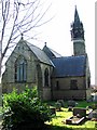
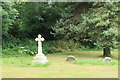
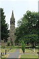
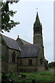
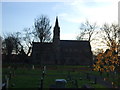
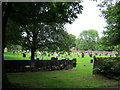
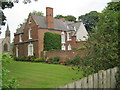
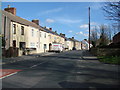
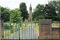
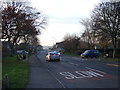
Please click the More button for more images, licensing and image copyright information.
Durham and nearby Videos From YouTube
Pelaw Wood - AWESOME places to visit in Durham!
Footage from Pelaw Wood on the way into Durham City. Great walk and also good for biking! Nice views of Durham Cathedral all ...
Channel: Drone Durham (View Channel)
Published: 6 May 2020
Police
This area is policed by Durham Constabulary.
Durham Constabulary split their policing area into 71 separate neighbourhoods and this postcode is in the Durham (Sherburn Village-Sherburn Hill) neighbourhood.

Durham (Sherburn Village-Sherburn Hill) Neighbourhood Crime
Top 3 Categories
For full details of all categories together with more crime information, click on the Details button.
Member of UK Parliament
Unfortunately, Parliamentary details are not available for this postcode.
Most Recent House Sales for Talisman Close, DH6 1RJ
29 Sep 2023
14 Oct 2022
1 Apr 2021
7 Oct 2014
Local Petrol Station Prices
Coordinates for DH6 1RJ
Residents at DH6 1RJ
Sunrise and Sunset at DH6 1RJ
Traffic Emission and Congestion Zones
Historical Weather Summary
| Clear | 12.20% |
| Cloudy | 76.39% |
| Rain | 7.97% |
| Windy | 3.02% |
| Other | 0.42% |
Population
Deprivation Index
the more deprived the postcode
Average Energy Performance
Companies Registered at DH6 1RJ
Postcode Details for DH6 1RJ
Recent Updates
|
18 Apr 2024 Added Traffic Camera Views from Traffic Scotland to Roadworks within Scotland |
|
15 Apr 2024 Schools Data updated for April 2024 |
|
10 Apr 2024 Companies Data updated for March 2024 |
|
7 Apr 2024 New option to receive automatic updates to roadworks that affect you |
|
7 Apr 2024 Police and Crime data updated for February 2024 |
|
3 Apr 2024 Sold House Price data updated for February 2024 |
|
30 Mar 2024 Energy Performance Certificates (England and Wales) updated February 2024 |
|
28 Mar 2024 New feature to use Geolocating functions to detect your current location |
Random Postcodes
Want an idea of what is in our extensive website? Try somewhere completely random!
The Rural/Urban classification is based upon data collected during the 2011 Census and released in August 2013 and is categorised into 6 distinct classes.
[A] Urban Major conurbation: A built up area with a population of 10,000 (3,000 in Scotland) or more and is assigned to the major conurbation settlement category.
[B] Urban Minor conurbation: A built up area with a population of 10,000 (3,000 in Scotland) or more and is assigned to the minor conurbation settlement category.
[C] Urban City and town: A built up area with a population of 10,000 (3,000 in Scotland) or more and is assigned to the city and town settlement category.
[D] Rural Town and fringe
[E] Rural Village
[F] Rural Hamlet and isolated dwelling
The Index of Multiple Deprivation (IMD) is the official measure of relative deprivation.
The index is based on 39 separate indicators across seven distinct domains (Income; Employment; Health and Disability; Education, Skills and Training; Crime; Barriers to Housing and Services; Living Environment) to provide an overall measure of multiple deprivation and is calculated for every neighbourhood.
The index is relative rather than an absolute scale and so a neighbourhood with a score of 10 is more deprived than one rated 20, but this does not equate to being twice as deprived.
Please note: Different indices are used in England, Scotland, Wales and Northern Ireland and so comparison of scores from neighbourhoods in different countries should not be undertaken.
These figures report on incorporated UK companies only that are registered at this postcode and do not include sole-traders, partnerships or overseas organisations.
The population figure shown for your area are an estimate provided by the Office for National Statistics and is rounded to the nearest 1,000.
The estimates are derived from the Annual Population Survey (APS) which is the Labour Force Survey (LFS) plus various sample boosts.
There are 55 unitary authorities. They provide all local government services in their areas. These are mainly in the cities, urban areas and larger towns although there are now 6 shire county councils that are unitary (ie have no district councils beneath them).