Overview for Grover Avenue, LANCING, BN15 9RF
Introduction
Lancing is a large coastal village and civil parish in the Adur district of West Sussex, England, on the western edge of the Adur Valley. It occupies part of the narrow central section of the Sussex coastal plain between smaller Sompting to the west, larger Shoreham-by-Sea to the east, and the parish of Coombes to the north. Excluding definitive suburbs it may have the largest undivided village cluster in Britain. However, its economy is commonly analysed as integral to the Brighton/Worthing/Littlehampton conurbation. Its settled area beneath the South Downs National Park covers 3.65 square miles (9.5 square kilometres; 2,340 acres), the majority of its land.
The Lancing area is characterised by mid-rise coastal urban homes, farmland, and wildlife reserves of the northern chalk downs and River Adur estuary. There are non-religious structures that date back to the early 16th century. The population in 2002 was approximately 19,000 in 2002. In the 2011 census the population for Lancing and Coombes was recorded as 18,810.
The village was a popular seaside resort in the mid-19th century. Summer tourist hallmarks are the traditional guesthouses on the A259 coast road, as well as a caravan/campsite in Old Salts Farm Road, and beach chair hire and ice cream businesses.
Summary for Grover Avenue, LANCING, BN15 9RF
Roadworks near BN15 9RF
Road Safety near BN15 9RF
Details of personal injury accidents in and around Grover Avenue, BN15 9RF that have been reported to Sussex Police over the past 20 years.
Traffic Levels near BN15 9RF
View traffic levels near Grover Avenue, BN15 9RF from official Department for Transport counts.
Images taken near to Grover Avenue, BN15 9RF and the surrounding area
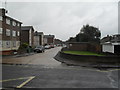
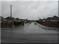
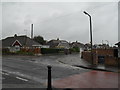
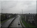
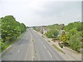
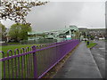
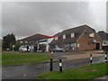
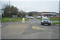
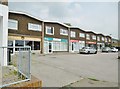
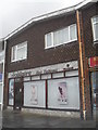
Please click the More button for more images, licensing and image copyright information.
Police
This area is policed by Sussex Police.
Sussex Police split their policing area into 273 separate neighbourhoods and this postcode is in the Manor neighbourhood.

Manor Neighbourhood Crime
Top 3 Categories
For full details of all categories together with more crime information, click on the Details button.
Member of UK Parliament
This postcode is in the East Worthing and Shoreham parliamentary constituency.
East Worthing and Shoreham is a constituency in the South East region of England. The seat has been held by Tim Loughton (Conservative) since May 2010.

Most Recent House Sales for Grover Avenue, BN15 9RF
6 Dec 2018
23 Feb 2018
31 Oct 2017
14 Sep 2017
Local Petrol Station Prices
Coordinates for BN15 9RF
Residents at BN15 9RF
Sunrise and Sunset at BN15 9RF
Traffic Emission and Congestion Zones
Historical Weather Summary
| Clear | 19.64% |
| Cloudy | 42.29% |
| Rain | 7.19% |
| Windy | 30.62% |
| Other | 0.26% |
Population
Deprivation Index
the more deprived the postcode
Average Energy Performance
Companies Registered at BN15 9RF
Postcode Details for BN15 9RF
Recent Updates
|
18 Apr 2024 Added Traffic Camera Views from Traffic Scotland to Roadworks within Scotland |
|
15 Apr 2024 Schools Data updated for April 2024 |
|
10 Apr 2024 Companies Data updated for March 2024 |
|
7 Apr 2024 New option to receive automatic updates to roadworks that affect you |
|
7 Apr 2024 Police and Crime data updated for February 2024 |
|
3 Apr 2024 Sold House Price data updated for February 2024 |
|
30 Mar 2024 Energy Performance Certificates (England and Wales) updated February 2024 |
|
28 Mar 2024 New feature to use Geolocating functions to detect your current location |
Random Postcodes
Want an idea of what is in our extensive website? Try somewhere completely random!
The Rural/Urban classification is based upon data collected during the 2011 Census and released in August 2013 and is categorised into 6 distinct classes.
[A] Urban Major conurbation: A built up area with a population of 10,000 (3,000 in Scotland) or more and is assigned to the major conurbation settlement category.
[B] Urban Minor conurbation: A built up area with a population of 10,000 (3,000 in Scotland) or more and is assigned to the minor conurbation settlement category.
[C] Urban City and town: A built up area with a population of 10,000 (3,000 in Scotland) or more and is assigned to the city and town settlement category.
[D] Rural Town and fringe
[E] Rural Village
[F] Rural Hamlet and isolated dwelling
The Index of Multiple Deprivation (IMD) is the official measure of relative deprivation.
The index is based on 39 separate indicators across seven distinct domains (Income; Employment; Health and Disability; Education, Skills and Training; Crime; Barriers to Housing and Services; Living Environment) to provide an overall measure of multiple deprivation and is calculated for every neighbourhood.
The index is relative rather than an absolute scale and so a neighbourhood with a score of 10 is more deprived than one rated 20, but this does not equate to being twice as deprived.
Please note: Different indices are used in England, Scotland, Wales and Northern Ireland and so comparison of scores from neighbourhoods in different countries should not be undertaken.
These figures report on incorporated UK companies only that are registered at this postcode and do not include sole-traders, partnerships or overseas organisations.
The population figure shown for your area are an estimate provided by the Office for National Statistics and is rounded to the nearest 1,000.
The estimates are derived from the Annual Population Survey (APS) which is the Labour Force Survey (LFS) plus various sample boosts.
There are 26 county councils in 2-tier areas, providing services such as education, social services and waste disposal.
In 2-tier areas, each county council area is subdivided into districts, for which there is an independent district council. There are 192 district councils.
District councils are responsible for local services such as rubbish collection, housing and planning applications.