Overview for Ramsgreave Road, BLACKBURN, BB1 9BH
Introduction
Blackburn is an industrial town and the administrative centre of the Blackburn with Darwen borough in Lancashire, England. The town is north of the West Pennine Moors on the southern edge of the Ribble Valley, 8 mi (13 km) east of Preston and 21 mi (34 km) north-northwest of Manchester. Blackburn is the core centre of the wider unitary authority area along with the town of Darwen. It is the second largest town (after Blackpool) in Lancashire.
At the 2011 census, Blackburn had a population of 117,963, whilst the wider borough of Blackburn with Darwen had a population of 150,030. Blackburn had a population of 117,963 in 2011, with 30.8% being people of ethnic backgrounds other than white British.
A former mill town, textiles have been produced in Blackburn since the middle of the 13th century, when wool was woven in people's houses in the domestic system. Flemish weavers who settled in the area in the 14th century helped to develop the woollen cottage industry. The most rapid period of growth and development in Blackburn's history coincided with the industrialisation and expansion of textile manufacturing.
Blackburn's textile sector fell into decline from the mid-20th century and subsequently faced similar challenges to other post-industrial northern towns, including deindustrialisation, economic deprivation and housing problems. Blackburn has had significant investment and redevelopment since 1958 through government funding and the European Regional Development Fund.
Summary for Ramsgreave Road, BLACKBURN, BB1 9BH
Roadworks near BB1 9BH
Road Safety near BB1 9BH
Details of personal injury accidents in and around Ramsgreave Road, BB1 9BH that have been reported to Lancashire Constabulary over the past 20 years.
Traffic Levels near BB1 9BH
View traffic levels near Ramsgreave Road, BB1 9BH from official Department for Transport counts.
Images taken near to Ramsgreave Road, BB1 9BH and the surrounding area
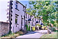
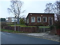
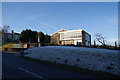
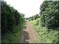
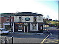
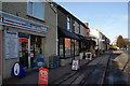
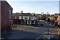
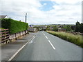
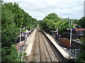
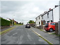
Please click the More button for more images, licensing and image copyright information.
Blackburn and nearby Videos From YouTube
Briten Long Shot 4K Video | Drone Shot
Drone #Drone_Shot #4k_Video About Video Essential Drone Cinematography Techniques Briten Long Shot 4K Video | Drone ...
Channel: Drone Shot (View Channel)
Published: 5 Jun 2021
Police
This area is policed by Lancashire Constabulary.
Lancashire Constabulary split their policing area into 236 separate neighbourhoods and this postcode is in the Mellor, Clayton le Dale with Ramsgreave and Wilpshire neighbourhood.

Mellor, Clayton le Dale with Ramsgreave and Wilpshire Neighbourhood Crime
Top 3 Categories
For full details of all categories together with more crime information, click on the Details button.
Member of UK Parliament
This postcode is in the Ribble Valley parliamentary constituency.
Ribble Valley is a constituency in the North West region of England. The seat has been held by Mr Nigel Evans (Conservative) since May 2010.

Most Recent House Sales for Ramsgreave Road, BB1 9BH
1 Sep 2023
1 Feb 2023
23 Sep 2022
26 May 2021
Local Petrol Station Prices
Coordinates for BB1 9BH
Residents at BB1 9BH
Sunrise and Sunset at BB1 9BH
Traffic Emission and Congestion Zones
Historical Weather Summary
| Clear | 7.16% |
| Cloudy | 57.10% |
| Rain | 12.94% |
| Windy | 22.46% |
| Other | 0.34% |
Population
Deprivation Index
the more deprived the postcode
Average Energy Performance
Companies Registered at BB1 9BH
Postcode Details for BB1 9BH
Recent Updates
|
18 Apr 2024 Added Traffic Camera Views from Traffic Scotland to Roadworks within Scotland |
|
15 Apr 2024 Schools Data updated for April 2024 |
|
10 Apr 2024 Companies Data updated for March 2024 |
|
7 Apr 2024 New option to receive automatic updates to roadworks that affect you |
|
7 Apr 2024 Police and Crime data updated for February 2024 |
|
3 Apr 2024 Sold House Price data updated for February 2024 |
|
30 Mar 2024 Energy Performance Certificates (England and Wales) updated February 2024 |
|
28 Mar 2024 New feature to use Geolocating functions to detect your current location |
Random Postcodes
Want an idea of what is in our extensive website? Try somewhere completely random!
The Rural/Urban classification is based upon data collected during the 2011 Census and released in August 2013 and is categorised into 6 distinct classes.
[A] Urban Major conurbation: A built up area with a population of 10,000 (3,000 in Scotland) or more and is assigned to the major conurbation settlement category.
[B] Urban Minor conurbation: A built up area with a population of 10,000 (3,000 in Scotland) or more and is assigned to the minor conurbation settlement category.
[C] Urban City and town: A built up area with a population of 10,000 (3,000 in Scotland) or more and is assigned to the city and town settlement category.
[D] Rural Town and fringe
[E] Rural Village
[F] Rural Hamlet and isolated dwelling
The Index of Multiple Deprivation (IMD) is the official measure of relative deprivation.
The index is based on 39 separate indicators across seven distinct domains (Income; Employment; Health and Disability; Education, Skills and Training; Crime; Barriers to Housing and Services; Living Environment) to provide an overall measure of multiple deprivation and is calculated for every neighbourhood.
The index is relative rather than an absolute scale and so a neighbourhood with a score of 10 is more deprived than one rated 20, but this does not equate to being twice as deprived.
Please note: Different indices are used in England, Scotland, Wales and Northern Ireland and so comparison of scores from neighbourhoods in different countries should not be undertaken.
These figures report on incorporated UK companies only that are registered at this postcode and do not include sole-traders, partnerships or overseas organisations.
The population figure shown for your area are an estimate provided by the Office for National Statistics and is rounded to the nearest 1,000.
The estimates are derived from the Annual Population Survey (APS) which is the Labour Force Survey (LFS) plus various sample boosts.
There are 26 county councils in 2-tier areas, providing services such as education, social services and waste disposal.
In 2-tier areas, each county council area is subdivided into districts, for which there is an independent district council. There are 192 district councils.
District councils are responsible for local services such as rubbish collection, housing and planning applications.