Overview for Virgil Street, ST. HELENS, WA10 4HE
Introduction
St Helens is a large town in Merseyside, England, with a population of 102,629. It is the administrative centre of the Metropolitan Borough of St Helens, which had a population of 183,200 at the 2021 Census.
The town is 6 miles (10 kilometres) north of the River Mersey, in the south-west part of historic Lancashire. The town was initially a small settlement within the historic county's ancient hundred of West Derby in the township of Windle but by the mid 1700s the had developed into a larger urban area beyond the townships borders. By 1838 the council was formally made responsible for the administration of Windle and the three other townships of Eccleston, Parr and Sutton that were to form the towns traditional shape. In 1868 the town was incorporated as a municipal borough, then later became a county borough in 1887. In 1974 the town was made a metropolitan borough within the new Metropolitan County of Merseyside by the Local Government Act 1972, with an expanded administrative responsibility for several nearby towns and villages.
The town was famous for its heavy industry, particularly its role in the coal mining industry, glassmaking, chemicals and copper smelting and sail making that drove its growth throughout the Industrial Revolution. Originally home to a large number of industrial employers such as Beechams, the Gamble Alkali Works, Ravenhead Glass, United Glass Bottles (UGB), Triplex, Daglish Foundry, Greenall's brewery, the glass producer Pilkington is the town's only remaining large industrial employer.
The town is today most famous for its Rugby League team St Helens R.
F.
C. who have won 3 World Club Challenge cups in recent years, and museums such as the North West Museum of Road Transport, the World of Glass and art installations such as Dream.
Summary for Virgil Street, ST. HELENS, WA10 4HE
Roadworks near WA10 4HE
Road Safety near WA10 4HE
Details of personal injury accidents in and around Virgil Street, WA10 4HE that have been reported to Merseyside Police over the past 20 years.
Traffic Levels near WA10 4HE
View traffic levels near Virgil Street, WA10 4HE from official Department for Transport counts.
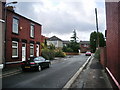
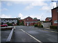
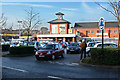
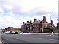
Images taken near to Virgil Street, WA10 4HE and the surrounding area
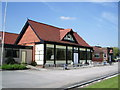
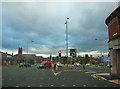
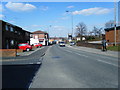
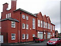
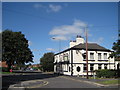
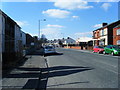
Please click the More button for more images, licensing and image copyright information.
St. Helens and nearby Videos From YouTube
St Helens RFC - Totally Wicked Stadium - #Langtree Park - drone overview in 4k
Flyover of the totally wicked stadium #sthelens #langtree.
Channel: CP OVERVIEW (View Channel)
Published: 22 Sep 2023
Police
This area is policed by Merseyside Police.
Merseyside Police split their policing area into 139 separate neighbourhoods and this postcode is in the West Park neighbourhood.

West Park Neighbourhood Crime
Top 3 Categories
For full details of all categories together with more crime information, click on the Details button.
Member of UK Parliament
Unfortunately, Parliamentary details are not available for this postcode.
Most Recent House Sales for Virgil Street, WA10 4HE
25 Jun 2021
29 Mar 2019
29 Sep 2016
16 Sep 2016
Local Petrol Station Prices
Coordinates for WA10 4HE
Residents at WA10 4HE
Sunrise and Sunset at WA10 4HE
Traffic Emission and Congestion Zones
Historical Weather Summary
| Clear | 17.67% |
| Cloudy | 60.41% |
| Rain | 7.63% |
| Windy | 14.25% |
| Other | 0.04% |
Population
Deprivation Index
the more deprived the postcode
Average Energy Performance
Companies Registered at WA10 4HE
Postcode Details for WA10 4HE
Recent Updates
|
18 Apr 2024 Added Traffic Camera Views from Traffic Scotland to Roadworks within Scotland |
|
15 Apr 2024 Schools Data updated for April 2024 |
|
10 Apr 2024 Companies Data updated for March 2024 |
|
7 Apr 2024 New option to receive automatic updates to roadworks that affect you |
|
7 Apr 2024 Police and Crime data updated for February 2024 |
|
3 Apr 2024 Sold House Price data updated for February 2024 |
|
30 Mar 2024 Energy Performance Certificates (England and Wales) updated February 2024 |
|
28 Mar 2024 New feature to use Geolocating functions to detect your current location |
Random Postcodes
Want an idea of what is in our extensive website? Try somewhere completely random!
The Rural/Urban classification is based upon data collected during the 2011 Census and released in August 2013 and is categorised into 6 distinct classes.
[A] Urban Major conurbation: A built up area with a population of 10,000 (3,000 in Scotland) or more and is assigned to the major conurbation settlement category.
[B] Urban Minor conurbation: A built up area with a population of 10,000 (3,000 in Scotland) or more and is assigned to the minor conurbation settlement category.
[C] Urban City and town: A built up area with a population of 10,000 (3,000 in Scotland) or more and is assigned to the city and town settlement category.
[D] Rural Town and fringe
[E] Rural Village
[F] Rural Hamlet and isolated dwelling
The Index of Multiple Deprivation (IMD) is the official measure of relative deprivation.
The index is based on 39 separate indicators across seven distinct domains (Income; Employment; Health and Disability; Education, Skills and Training; Crime; Barriers to Housing and Services; Living Environment) to provide an overall measure of multiple deprivation and is calculated for every neighbourhood.
The index is relative rather than an absolute scale and so a neighbourhood with a score of 10 is more deprived than one rated 20, but this does not equate to being twice as deprived.
Please note: Different indices are used in England, Scotland, Wales and Northern Ireland and so comparison of scores from neighbourhoods in different countries should not be undertaken.
These figures report on incorporated UK companies only that are registered at this postcode and do not include sole-traders, partnerships or overseas organisations.
The population figure shown for your area are an estimate provided by the Office for National Statistics and is rounded to the nearest 1,000.
The estimates are derived from the Annual Population Survey (APS) which is the Labour Force Survey (LFS) plus various sample boosts.
There are 36 metropolitan district councils which together cover 6 large urban areas: the counties of Greater Manchester, Merseyside, South Yorkshire, Tyne and Wear, West Midlands, and West Yorkshire.
Metropolitan districts are responsible for all services in their area, although certain conurbation wide services such as fire and civil defence, police, waste disposal and passenger transport are provided through joint authorities (the districts acting jointly).