Overview for Holeyn Hall Road, WYLAM, NE41 8BE
Introduction
Wylam is a village and civil parish in the county of Northumberland. It is located about 10 miles (16 km) west of Newcastle upon Tyne.
It is famous for the being the birthplace of George Stephenson, one of the early railway pioneers. George Stephenson's Birthplace, his cottage, can be found on the north bank of the Tyne 3⁄4 mile (1.2 km) east of the village centre. It is owned by the National Trust but is not open to the public in 2021 on account of COVID-19.
Wylam has further connections with the early railway pioneers. The steam locomotive engineer Timothy Hackworth, who worked with Stephenson, was also born here. William Hedley who was born in the nearby village of Newburn attended the village school. He later went on to design and manufacture Puffing Billy in 1813, two years before George Stephenson produced his first locomotive Blücher. Christopher Blackett as lord of the manor in the first 30 years of the 19th century provided the entrepreneurial drive that encouraged these engineers.
Summary for Holeyn Hall Road, WYLAM, NE41 8BE
Roadworks near NE41 8BE
Road Safety near NE41 8BE
Details of personal injury accidents in and around Holeyn Hall Road, NE41 8BE that have been reported to Northumbria Police over the past 20 years.
Traffic Levels near NE41 8BE
View traffic levels near Holeyn Hall Road, NE41 8BE from official Department for Transport counts.
Images taken near to Holeyn Hall Road, NE41 8BE and the surrounding area
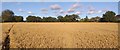
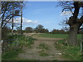
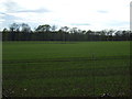
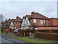
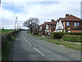

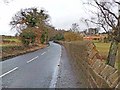
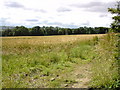
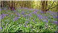
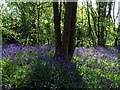
Please click the More button for more images, licensing and image copyright information.
Police
This area is policed by Northumbria Police.
Northumbria Police split their policing area into 35 separate neighbourhoods and this postcode is in the East Tynedale neighbourhood.

East Tynedale Neighbourhood Crime
Top 3 Categories
For full details of all categories together with more crime information, click on the Details button.
Member of UK Parliament
This postcode is in the Hexham parliamentary constituency.
Hexham is a constituency in the North East region of England. The seat has been held by Guy Opperman (Conservative) since May 2010.

Most Recent House Sales for Holeyn Hall Road, NE41 8BE
14 Sep 2016
16 Dec 2005
14 Oct 2005
17 Apr 2003
Local Petrol Station Prices
Coordinates for NE41 8BE
Residents at NE41 8BE
Sunrise and Sunset at NE41 8BE
Traffic Emission and Congestion Zones
Historical Weather Summary
| Clear | 8.77% |
| Cloudy | 57.43% |
| Rain | 8.61% |
| Windy | 25.06% |
| Other | 0.13% |
Population
Deprivation Index
the more deprived the postcode
Average Energy Performance
Companies Registered at NE41 8BE
Postcode Details for NE41 8BE
Recent Updates
|
18 Apr 2024 Added Traffic Camera Views from Traffic Scotland to Roadworks within Scotland |
|
15 Apr 2024 Schools Data updated for April 2024 |
|
10 Apr 2024 Companies Data updated for March 2024 |
|
7 Apr 2024 New option to receive automatic updates to roadworks that affect you |
|
7 Apr 2024 Police and Crime data updated for February 2024 |
|
3 Apr 2024 Sold House Price data updated for February 2024 |
|
30 Mar 2024 Energy Performance Certificates (England and Wales) updated February 2024 |
|
28 Mar 2024 New feature to use Geolocating functions to detect your current location |
Random Postcodes
Want an idea of what is in our extensive website? Try somewhere completely random!
The Rural/Urban classification is based upon data collected during the 2011 Census and released in August 2013 and is categorised into 6 distinct classes.
[A] Urban Major conurbation: A built up area with a population of 10,000 (3,000 in Scotland) or more and is assigned to the major conurbation settlement category.
[B] Urban Minor conurbation: A built up area with a population of 10,000 (3,000 in Scotland) or more and is assigned to the minor conurbation settlement category.
[C] Urban City and town: A built up area with a population of 10,000 (3,000 in Scotland) or more and is assigned to the city and town settlement category.
[D] Rural Town and fringe
[E] Rural Village
[F] Rural Hamlet and isolated dwelling
The Index of Multiple Deprivation (IMD) is the official measure of relative deprivation.
The index is based on 39 separate indicators across seven distinct domains (Income; Employment; Health and Disability; Education, Skills and Training; Crime; Barriers to Housing and Services; Living Environment) to provide an overall measure of multiple deprivation and is calculated for every neighbourhood.
The index is relative rather than an absolute scale and so a neighbourhood with a score of 10 is more deprived than one rated 20, but this does not equate to being twice as deprived.
Please note: Different indices are used in England, Scotland, Wales and Northern Ireland and so comparison of scores from neighbourhoods in different countries should not be undertaken.
These figures report on incorporated UK companies only that are registered at this postcode and do not include sole-traders, partnerships or overseas organisations.
The population figure shown for your area are an estimate provided by the Office for National Statistics and is rounded to the nearest 1,000.
The estimates are derived from the Annual Population Survey (APS) which is the Labour Force Survey (LFS) plus various sample boosts.
There are 55 unitary authorities. They provide all local government services in their areas. These are mainly in the cities, urban areas and larger towns although there are now 6 shire county councils that are unitary (ie have no district councils beneath them).