Overview for Gurner Avenue, SALFORD, M5 3WP
Introduction
Salford (SOL-fərd) is a city in Greater Manchester, England. The city is situated in a meander on the western bank of the River Irwell which forms its boundary with Manchester and its city centre. Landmarks in the city include the 100 Greengate skyscraper, the old town hall, cathedral and St Philips Church. It is the main settlement of the wider City of Salford metropolitan borough.
Nearby towns in the built-up area include Stretford, Bolton, Sale and Bury with additional towns nearby being Prestwich, Radcliffe and Urmston. The wider metropolitan borough includes the towns of Eccles, Pendlebury, Swinton, Walkden and other surrounding villages and suburbs.
It was the former Salfordshire's judicial seat in historic county of Lancashire. It was granted a market charter in about 1230 by Ranulf de Blondeville, 6th Earl of Chester. These two initially made it of greater cultural and commercial importance than neighbouring Manchester: the Industrial Revolution of the late 18th and early 19th centuries reversed that relationship. The former County Borough of Salford was granted city status in 1926: the current wider borough was established in 1974.
The economy of the city was focused on a major cotton and silk spinning and weaving factory district in the 18th and 19th centuries and important inland port on the Manchester Ship Canal from 1894. Industrial decline in the 20th century lead to the city having run-down and antisocial areas. Multiple media sector headquarters relocated to the Salford Quays development called MediaCityUK to replace the loss of heavy industrial. Notable establishments and companies in the city include the University of Salford, Salford City Football Club, Salford Red Devils,Salford Lads' Club, BBC North and ITV Granada.
Summary for Gurner Avenue, SALFORD, M5 3WP
Roadworks near M5 3WP
Road Safety near M5 3WP
Details of personal injury accidents in and around Gurner Avenue, M5 3WP that have been reported to Greater Manchester Police over the past 20 years.
Traffic Levels near M5 3WP
View traffic levels near Gurner Avenue, M5 3WP from official Department for Transport counts.
Images taken near to Gurner Avenue, M5 3WP and the surrounding area
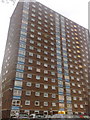
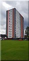
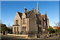
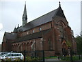
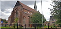
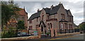
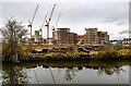
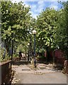
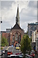
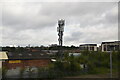
Please click the More button for more images, licensing and image copyright information.
Member of UK Parliament
This postcode is in the Salford and Eccles parliamentary constituency.
Salford and Eccles is a constituency in the North West region of England. The seat has been held by Rebecca Long Bailey (Labour) since May 2015.

Most Recent House Sales for Gurner Avenue, M5 3WP
27 May 2022
20 Feb 2012
6 Mar 2009
21 Mar 2005
Local Petrol Station Prices
Coordinates for M5 3WP
Residents at M5 3WP
Sunrise and Sunset at M5 3WP
Traffic Emission and Congestion Zones
Historical Weather Summary
| Clear | 17.00% |
| Cloudy | 56.08% |
| Rain | 7.70% |
| Windy | 19.05% |
| Other | 0.17% |
Population
Deprivation Index
the more deprived the postcode
Average Energy Performance
Companies Registered at M5 3WP
Postcode Details for M5 3WP
Recent Updates
|
18 Apr 2024 Added Traffic Camera Views from Traffic Scotland to Roadworks within Scotland |
|
15 Apr 2024 Schools Data updated for April 2024 |
|
10 Apr 2024 Companies Data updated for March 2024 |
|
7 Apr 2024 New option to receive automatic updates to roadworks that affect you |
|
7 Apr 2024 Police and Crime data updated for February 2024 |
|
3 Apr 2024 Sold House Price data updated for February 2024 |
|
30 Mar 2024 Energy Performance Certificates (England and Wales) updated February 2024 |
|
28 Mar 2024 New feature to use Geolocating functions to detect your current location |
Random Postcodes
Want an idea of what is in our extensive website? Try somewhere completely random!
The Rural/Urban classification is based upon data collected during the 2011 Census and released in August 2013 and is categorised into 6 distinct classes.
[A] Urban Major conurbation: A built up area with a population of 10,000 (3,000 in Scotland) or more and is assigned to the major conurbation settlement category.
[B] Urban Minor conurbation: A built up area with a population of 10,000 (3,000 in Scotland) or more and is assigned to the minor conurbation settlement category.
[C] Urban City and town: A built up area with a population of 10,000 (3,000 in Scotland) or more and is assigned to the city and town settlement category.
[D] Rural Town and fringe
[E] Rural Village
[F] Rural Hamlet and isolated dwelling
The Index of Multiple Deprivation (IMD) is the official measure of relative deprivation.
The index is based on 39 separate indicators across seven distinct domains (Income; Employment; Health and Disability; Education, Skills and Training; Crime; Barriers to Housing and Services; Living Environment) to provide an overall measure of multiple deprivation and is calculated for every neighbourhood.
The index is relative rather than an absolute scale and so a neighbourhood with a score of 10 is more deprived than one rated 20, but this does not equate to being twice as deprived.
Please note: Different indices are used in England, Scotland, Wales and Northern Ireland and so comparison of scores from neighbourhoods in different countries should not be undertaken.
These figures report on incorporated UK companies only that are registered at this postcode and do not include sole-traders, partnerships or overseas organisations.
The population figure shown for your area are an estimate provided by the Office for National Statistics and is rounded to the nearest 1,000.
The estimates are derived from the Annual Population Survey (APS) which is the Labour Force Survey (LFS) plus various sample boosts.
There are 36 metropolitan district councils which together cover 6 large urban areas: the counties of Greater Manchester, Merseyside, South Yorkshire, Tyne and Wear, West Midlands, and West Yorkshire.
Metropolitan districts are responsible for all services in their area, although certain conurbation wide services such as fire and civil defence, police, waste disposal and passenger transport are provided through joint authorities (the districts acting jointly).