Overview for The Brambles, ALDEBURGH, IP15 5LA
Introduction
Aldeburgh (AWL-bər-ə) is a coastal town in the county of Suffolk, England, north of the River Alde. Its estimated population was 2,276 in 2019. It was home to the composer Benjamin Britten and remains the centre of the international Aldeburgh Festival of arts at nearby Snape Maltings, which was founded by Britten in 1948. It also hosts an annual poetry festival and several food festivals and other events.
Aldeburgh, as a port, gained borough status in 1529 under Henry VIII. Its historic buildings include a 16th-century moot hall and a Napoleonic-era Martello Tower. A third of its housing consists of second homes. Visitors are drawn to its Blue Flag beach and fisherman huts, where fresh fish is sold, to Aldeburgh Yacht Club and to its cultural offerings. Two family-run fish and chip shops have been rated among the country's best. The independent Aldeburgh bookshop has been in business for over seventy years, is locally thought to have been the site of the birthplace of George Crabbe (1754-1832) and has organised the annual Aldeburgh Literary Festival since 2002.
Summary for The Brambles, ALDEBURGH, IP15 5LA
Roadworks near IP15 5LA
Road Safety near IP15 5LA
Details of personal injury accidents in and around The Brambles, IP15 5LA that have been reported to Suffolk Constabulary over the past 20 years.
Traffic Levels near IP15 5LA
View traffic levels near The Brambles, IP15 5LA from official Department for Transport counts.
Images taken near to The Brambles, IP15 5LA and the surrounding area
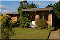
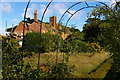

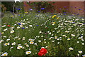
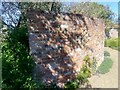

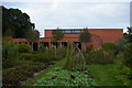
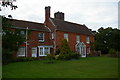
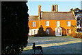

Please click the More button for more images, licensing and image copyright information.
Police
This area is policed by Suffolk Constabulary.
Suffolk Constabulary split their policing area into 50 separate neighbourhoods and this postcode is in the Leiston neighbourhood.

Leiston Neighbourhood Crime
Top 3 Categories
For full details of all categories together with more crime information, click on the Details button.
Member of UK Parliament
This postcode is in the Suffolk Coastal parliamentary constituency.
Suffolk Coastal is a constituency in the East of England region of England. The seat has been held by Dr Thérèse Coffey (Conservative) since May 2010.

Most Recent House Sales for The Brambles, IP15 5LA
15 Dec 2022
1 Feb 2019
30 Oct 2015
17 Aug 2011
Local Petrol Station Prices
Coordinates for IP15 5LA
Residents at IP15 5LA
Sunrise and Sunset at IP15 5LA
Traffic Emission and Congestion Zones
Historical Weather Summary
| Clear | 9.46% |
| Cloudy | 44.13% |
| Rain | 6.71% |
| Windy | 39.71% |
| Other | -0.01% |
Deprivation Index
the more deprived the postcode
Average Energy Performance
Companies Registered at IP15 5LA
Postcode Details for IP15 5LA
Recent Updates
|
18 Apr 2024 Added Traffic Camera Views from Traffic Scotland to Roadworks within Scotland |
|
15 Apr 2024 Schools Data updated for April 2024 |
|
10 Apr 2024 Companies Data updated for March 2024 |
|
7 Apr 2024 New option to receive automatic updates to roadworks that affect you |
|
7 Apr 2024 Police and Crime data updated for February 2024 |
|
3 Apr 2024 Sold House Price data updated for February 2024 |
|
30 Mar 2024 Energy Performance Certificates (England and Wales) updated February 2024 |
|
28 Mar 2024 New feature to use Geolocating functions to detect your current location |
Random Postcodes
Want an idea of what is in our extensive website? Try somewhere completely random!
The Rural/Urban classification is based upon data collected during the 2011 Census and released in August 2013 and is categorised into 6 distinct classes.
[A] Urban Major conurbation: A built up area with a population of 10,000 (3,000 in Scotland) or more and is assigned to the major conurbation settlement category.
[B] Urban Minor conurbation: A built up area with a population of 10,000 (3,000 in Scotland) or more and is assigned to the minor conurbation settlement category.
[C] Urban City and town: A built up area with a population of 10,000 (3,000 in Scotland) or more and is assigned to the city and town settlement category.
[D] Rural Town and fringe
[E] Rural Village
[F] Rural Hamlet and isolated dwelling
The Index of Multiple Deprivation (IMD) is the official measure of relative deprivation.
The index is based on 39 separate indicators across seven distinct domains (Income; Employment; Health and Disability; Education, Skills and Training; Crime; Barriers to Housing and Services; Living Environment) to provide an overall measure of multiple deprivation and is calculated for every neighbourhood.
The index is relative rather than an absolute scale and so a neighbourhood with a score of 10 is more deprived than one rated 20, but this does not equate to being twice as deprived.
Please note: Different indices are used in England, Scotland, Wales and Northern Ireland and so comparison of scores from neighbourhoods in different countries should not be undertaken.
These figures report on incorporated UK companies only that are registered at this postcode and do not include sole-traders, partnerships or overseas organisations.
The population figure shown for your area are an estimate provided by the Office for National Statistics and is rounded to the nearest 1,000.
The estimates are derived from the Annual Population Survey (APS) which is the Labour Force Survey (LFS) plus various sample boosts.
There are 26 county councils in 2-tier areas, providing services such as education, social services and waste disposal.
In 2-tier areas, each county council area is subdivided into districts, for which there is an independent district council. There are 192 district councils.
District councils are responsible for local services such as rubbish collection, housing and planning applications.