Overview for Redcliffe Street, CHEDDAR, BS27 3ND
Introduction
Cheddar is a large village and civil parish in the English county of Somerset. It is situated on the southern edge of the Mendip Hills, 9 miles (14 km) north-west of Wells, 11 miles (18 km) south-east of Weston-super-Mare and 18 miles (29 km) south-west of Bristol. The civil parish includes the hamlets of Nyland and Bradley Cross. The parish had a population of 5,755 in 2011 and an acreage of 8,592 acres (3,477 ha) as of 1961.
Cheddar Gorge, on the northern edge of the village, is the largest gorge in the United Kingdom and includes several show caves, including Gough's Cave. The gorge has been a centre of human settlement since Neolithic times, including a Saxon palace. It has a temperate climate and provides a unique geological and biological environment that has been recognised by the designation of several Sites of Special Scientific Interest. It is also the site of several limestone quarries. The village gave its name to Cheddar cheese and has been a centre for strawberry growing. The crop was formerly transported on the Cheddar Valley rail line, which closed in the late 1960s but is now a cycle path. The village is now a major tourist destination with several cultural and community facilities, including the Cheddar Show Caves Museum.
The village supports a variety of community groups including religious, sporting and cultural organisations. Several of these are based on the site of the Kings of Wessex Academy, which is the largest educational establishment.
Summary for Redcliffe Street, CHEDDAR, BS27 3ND
Roadworks near BS27 3ND
Road Safety near BS27 3ND
Details of personal injury accidents in and around Redcliffe Street, BS27 3ND that have been reported to Avon and Somerset Constabulary over the past 20 years.
Traffic Levels near BS27 3ND
View traffic levels near Redcliffe Street, BS27 3ND from official Department for Transport counts.
Images taken near to Redcliffe Street, BS27 3ND and the surrounding area
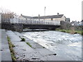
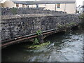
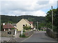
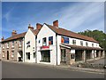
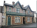
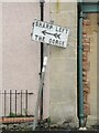
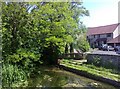
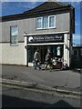
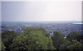
Please click the More button for more images, licensing and image copyright information.
Police
This area is policed by Avon and Somerset Constabulary.
Avon and Somerset Constabulary split their policing area into 123 separate neighbourhoods and this postcode is in the Sedgemoor North East neighbourhood.

Sedgemoor North East Neighbourhood Crime
Top 3 Categories
For full details of all categories together with more crime information, click on the Details button.
Member of UK Parliament
This postcode is in the Wells parliamentary constituency.
Wells is a constituency in the South West region of England. The seat has been held by James Heappey (Conservative) since May 2015.

Most Recent House Sales for Redcliffe Street, BS27 3ND
27 Jan 2023
7 Mar 2016
21 Dec 2005
1 Mar 2002
Local Petrol Station Prices
Coordinates for BS27 3ND
Residents at BS27 3ND
Sunrise and Sunset at BS27 3ND
Traffic Emission and Congestion Zones
Historical Weather Summary
| Clear | 20.03% |
| Cloudy | 62.83% |
| Rain | 7.58% |
| Windy | 9.30% |
| Other | 0.26% |
Deprivation Index
the more deprived the postcode
Average Energy Performance
Companies Registered at BS27 3ND
Postcode Details for BS27 3ND
Recent Updates
|
18 Apr 2024 Added Traffic Camera Views from Traffic Scotland to Roadworks within Scotland |
|
15 Apr 2024 Schools Data updated for April 2024 |
|
10 Apr 2024 Companies Data updated for March 2024 |
|
7 Apr 2024 New option to receive automatic updates to roadworks that affect you |
|
7 Apr 2024 Police and Crime data updated for February 2024 |
|
3 Apr 2024 Sold House Price data updated for February 2024 |
|
30 Mar 2024 Energy Performance Certificates (England and Wales) updated February 2024 |
|
28 Mar 2024 New feature to use Geolocating functions to detect your current location |
Random Postcodes
Want an idea of what is in our extensive website? Try somewhere completely random!
The Rural/Urban classification is based upon data collected during the 2011 Census and released in August 2013 and is categorised into 6 distinct classes.
[A] Urban Major conurbation: A built up area with a population of 10,000 (3,000 in Scotland) or more and is assigned to the major conurbation settlement category.
[B] Urban Minor conurbation: A built up area with a population of 10,000 (3,000 in Scotland) or more and is assigned to the minor conurbation settlement category.
[C] Urban City and town: A built up area with a population of 10,000 (3,000 in Scotland) or more and is assigned to the city and town settlement category.
[D] Rural Town and fringe
[E] Rural Village
[F] Rural Hamlet and isolated dwelling
The Index of Multiple Deprivation (IMD) is the official measure of relative deprivation.
The index is based on 39 separate indicators across seven distinct domains (Income; Employment; Health and Disability; Education, Skills and Training; Crime; Barriers to Housing and Services; Living Environment) to provide an overall measure of multiple deprivation and is calculated for every neighbourhood.
The index is relative rather than an absolute scale and so a neighbourhood with a score of 10 is more deprived than one rated 20, but this does not equate to being twice as deprived.
Please note: Different indices are used in England, Scotland, Wales and Northern Ireland and so comparison of scores from neighbourhoods in different countries should not be undertaken.
These figures report on incorporated UK companies only that are registered at this postcode and do not include sole-traders, partnerships or overseas organisations.
The population figure shown for your area are an estimate provided by the Office for National Statistics and is rounded to the nearest 1,000.
The estimates are derived from the Annual Population Survey (APS) which is the Labour Force Survey (LFS) plus various sample boosts.
There are 55 unitary authorities. They provide all local government services in their areas. These are mainly in the cities, urban areas and larger towns although there are now 6 shire county councils that are unitary (ie have no district councils beneath them).