Creswell Model Village
Introduction
The photograph on this page of Creswell Model Village by Alan Murray-Rust as part of the Geograph project.
The Geograph project started in 2005 with the aim of publishing, organising and preserving representative images for every square kilometre of Great Britain, Ireland and the Isle of Man.

There are currently over 7.5m images from over 14,400 individuals and you can help contribute to the project by visiting https://www.geograph.org.uk
Creswell Model Village
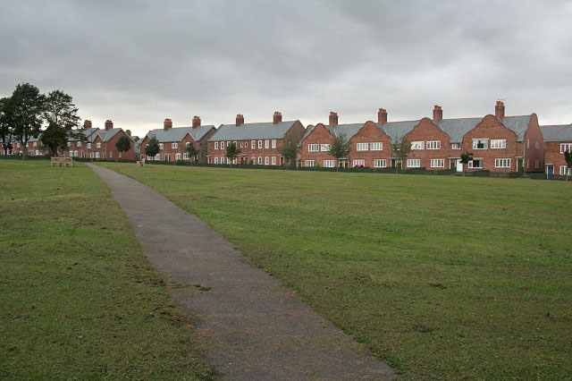
Image: © Alan Murray-Rust Taken: 30 Sep 2008
Built in 1896 to house workers at Creswell Colliery, the village consists of a double ring of houses, separated by a service road, around a large green in the form of an extended octagon. The houses are built in a variety of different designs. After a period of decline from the 1980s, the village has been turned round with the help of an active residents' Association and a large Heritage Lottery Fund award.
Images are licensed for reuse under creativecommons.org/licenses/by-sa/2.0
Image Location
Latitude
53.260091
Longitude
-1.220291