The Flying Fortress public house and restaurant
Introduction
The photograph on this page of The Flying Fortress public house and restaurant by John Goldsmith as part of the Geograph project.
The Geograph project started in 2005 with the aim of publishing, organising and preserving representative images for every square kilometre of Great Britain, Ireland and the Isle of Man.

There are currently over 7.5m images from over 14,400 individuals and you can help contribute to the project by visiting https://www.geograph.org.uk
The Flying Fortress public house and restaurant
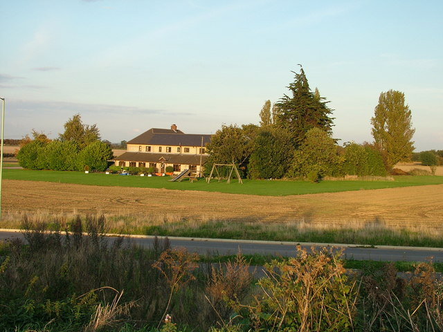
Image: © John Goldsmith Taken: 6 Oct 2008
The Flying Fortress, on the northern edge of Rougham Airfield, is named after the main aircraft type based here in WW2. It is viewed here from the top of an earth mound made during the new estate construction, and across an estate road that does not yet appear on Geograph's Landranger map, now named Lady Miriam Way. The pub, which was converted from a farmhouse, was known for its regular 'blog' in the local newspapers but closed some years ago. With much more house building in the area there are hopes that the owners, the brewers Greene King, may reopen it.
Images are licensed for reuse under creativecommons.org/licenses/by-sa/2.0
Image Location


Leaflet Map data © OpenStreetMap
Latitude
52.247937
Longitude
0.758956