The A685, Tebay
Introduction
The photograph on this page of The A685, Tebay by Andrew Smith as part of the Geograph project.
The Geograph project started in 2005 with the aim of publishing, organising and preserving representative images for every square kilometre of Great Britain, Ireland and the Isle of Man.

There are currently over 7.5m images from over 14,400 individuals and you can help contribute to the project by visiting https://www.geograph.org.uk
The A685, Tebay
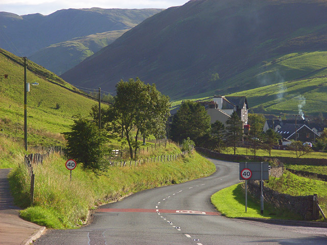
Image: © Andrew Smith Taken: 28 Sep 2008
The road leaving the main part of the village as it makes its way towards Kendal. The buildings ahead are just above the site of the former railway station. The former Junction Hotel is prominent. The narrow valley is that of the River Lune. It separates the Howgill Fells to the left from the foothills of the Lake District to the right. As well as the road, the M6 and the West Coast Mainline run through this gap in the hills.
Images are licensed for reuse under creativecommons.org/licenses/by-sa/2.0
Image Location
Latitude
54.430322
Longitude
-2.59374