Marsh Mill
Introduction
The photograph on this page of Marsh Mill by Roger W Haworth as part of the Geograph project.
The Geograph project started in 2005 with the aim of publishing, organising and preserving representative images for every square kilometre of Great Britain, Ireland and the Isle of Man.

There are currently over 7.5m images from over 14,400 individuals and you can help contribute to the project by visiting https://www.geograph.org.uk
Marsh Mill
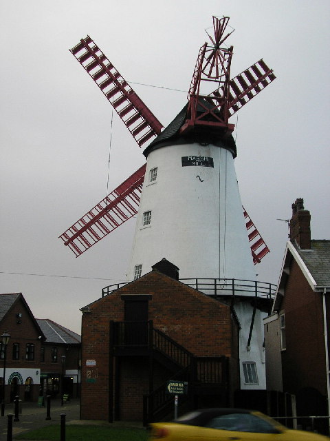
Image: © Roger W Haworth Taken: 23 Dec 2005
In Fleetwood Road, built in 1794. http://en.wikipedia.org/wiki/Thornton%2C_Lancashire More images by RWH: http://rhaworth.ucoz.net/sd/marshmil.htm Lots more images at Windmill World: http://www.windmillworld.com/millid/1460.htm
Images are licensed for reuse under creativecommons.org/licenses/by-sa/2.0
Image Location


Leaflet Map data © OpenStreetMap
Latitude
53.874421
Longitude
-3.012929