Washington Village Sign
Introduction
The photograph on this page of Washington Village Sign by Simon Carey as part of the Geograph project.
The Geograph project started in 2005 with the aim of publishing, organising and preserving representative images for every square kilometre of Great Britain, Ireland and the Isle of Man.

There are currently over 7.5m images from over 14,400 individuals and you can help contribute to the project by visiting https://www.geograph.org.uk
Washington Village Sign
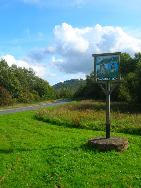
Image: © Simon Carey Taken: 2 Oct 2008
The road in the background is known as The Pike and is the current route of the A283. The sign is on an area of land known as The Triangle having been formed by the rerouting of The Pike away from its former junction opposite Brook House. The sign has three items on it; St Mary's Church, Rock Windmill and Chanctonbury Hill, all of which are located within the parish. The last named can be seen in the distance to the left of the sign. Most of this area was once part of Washington Common which was inclosed during the mid 19th century.
Images are licensed for reuse under creativecommons.org/licenses/by-sa/2.0
Image Location
Latitude
50.906287
Longitude
-0.404752