Bridge carrying A34 road, over disused railway line
Introduction
The photograph on this page of Bridge carrying A34 road, over disused railway line by Tim Marshall as part of the Geograph project.
The Geograph project started in 2005 with the aim of publishing, organising and preserving representative images for every square kilometre of Great Britain, Ireland and the Isle of Man.

There are currently over 7.5m images from over 14,400 individuals and you can help contribute to the project by visiting https://www.geograph.org.uk
Bridge carrying A34 road, over disused railway line
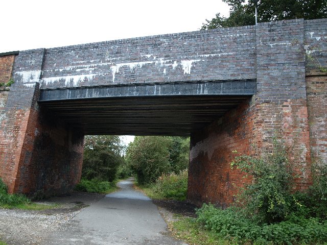
Image: © Tim Marshall Taken: 30 Sep 2008
Bridge carrying A34 road over the former GNR Stafford - Uttoxeter line, west of Stafford Common Station, closed to Passengers on 4th December 1939. The line survived for freight and for special servicemens trains until final closure to all regular traffic on 5th March 1951, the last train over the line being an SLS special in March 1957. The line east of Stafford Common Station was lifted in 1959 but the remainder was retained for use by engineers in connection with electrification work on the West Coast Main Line. This stub was finally taken out of use in December 1975.
Images are licensed for reuse under creativecommons.org/licenses/by-sa/2.0
Image Location
Latitude
52.820675
Longitude
-2.11867