Remains of Mytholm Mill
Introduction
The photograph on this page of Remains of Mytholm Mill by Phil Champion as part of the Geograph project.
The Geograph project started in 2005 with the aim of publishing, organising and preserving representative images for every square kilometre of Great Britain, Ireland and the Isle of Man.

There are currently over 7.5m images from over 14,400 individuals and you can help contribute to the project by visiting https://www.geograph.org.uk
Remains of Mytholm Mill
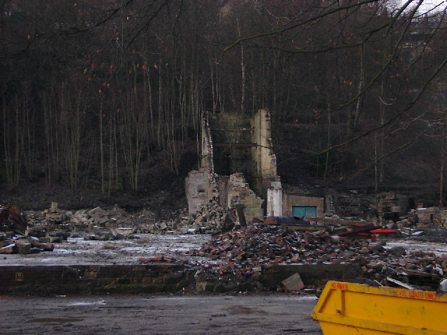
Image: © Phil Champion Taken: 27 Dec 2005
Demolition of Mytholm Mill began in December 2005. The original Mytholm Mill was constructed about 1789 by James King. Over the next 200 years the complex was used for a variety of purposes including cotton manufacturing and later as an engineering works. In 2005 planning permission was granted for redevelopment of the site for housing and business units. Demolition of Mytholm Mill began in December 2005. By the end of the month most of the buildings had been demolished. The building shown here was a wheel-house supplied by water from two dams on the wooded hillside behind. The history of the site is explored at http://www.charlestownhistory.org.uk/mytholm.html
Images are licensed for reuse under creativecommons.org/licenses/by-sa/2.0
Image Location


Leaflet Map data © OpenStreetMap
Latitude
53.742167
Longitude
-2.027709