St Andrew's Church
Introduction
The photograph on this page of St Andrew's Church by Simon Carey as part of the Geograph project.
The Geograph project started in 2005 with the aim of publishing, organising and preserving representative images for every square kilometre of Great Britain, Ireland and the Isle of Man.

There are currently over 7.5m images from over 14,400 individuals and you can help contribute to the project by visiting https://www.geograph.org.uk
St Andrew's Church
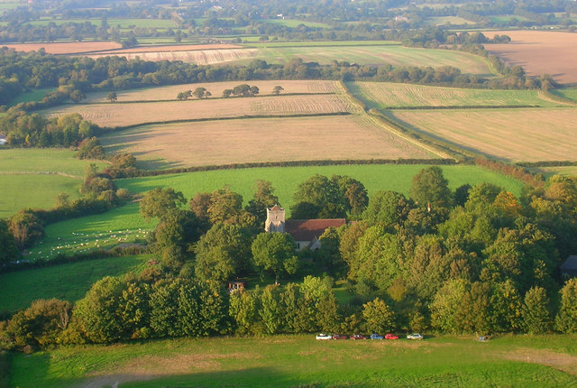
Image: © Simon Carey Taken: 27 Sep 2008
Its actually easier to get a shot of the church 500 feet up than from the ground. The church is mainly from the 13th and 14th centuries though it incorporates a wall from an earlier time. The tower was restored in the late 19th century. The foliage hides Edburton House whose chimneys can be seen north east of the church, whilst the chimneys of Michaelmas Cottage are south west of the church. The field below seems to be used as a banger racing circuit judging by the oval shape and the cars parked there.
Images are licensed for reuse under creativecommons.org/licenses/by-sa/2.0
Image Location


Leaflet Map data © OpenStreetMap
Latitude
50.889836
Longitude
-0.248343