Hoxton: Micawber Street, N1
Introduction
The photograph on this page of Hoxton: Micawber Street, N1 by Nigel Cox as part of the Geograph project.
The Geograph project started in 2005 with the aim of publishing, organising and preserving representative images for every square kilometre of Great Britain, Ireland and the Isle of Man.

There are currently over 7.5m images from over 14,400 individuals and you can help contribute to the project by visiting https://www.geograph.org.uk
Hoxton: Micawber Street, N1
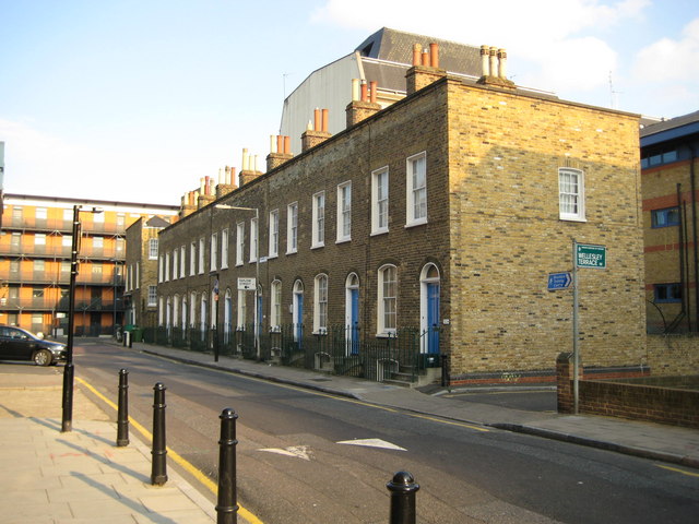
Image: © Nigel Cox Taken: 25 Sep 2008
The propensity of inner London councils to rename roads to something more whimsical or unique may lead to some interesting names but they do not help the amateur historian or genealogist in trying to identify exactly where an old road was. In this case the Dickensian Micawber Street has replaced the more mundane Edward Street, but this was Edward Street until, from the old Ordnance Survey mapping, some time between 1920 and 1938. Nonetheless, and despite being surrounded by much newer buildings, this block of housing on Micawber Street is a fine example of an early Victorian group of London townhouses.
Images are licensed for reuse under creativecommons.org/licenses/by-sa/2.0
Image Location
Latitude
51.530216
Longitude
-0.092821