Blea Tarn
Introduction
The photograph on this page of Blea Tarn by Oliver Dixon as part of the Geograph project.
The Geograph project started in 2005 with the aim of publishing, organising and preserving representative images for every square kilometre of Great Britain, Ireland and the Isle of Man.

There are currently over 7.5m images from over 14,400 individuals and you can help contribute to the project by visiting https://www.geograph.org.uk
Blea Tarn
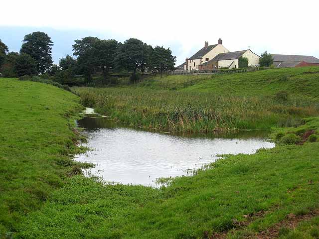
Image: © Oliver Dixon Taken: 24 Sep 2008
Blea Tarn occupies a section of the Vallum to the south of Hadrian's Wall. Seen from Hadrians Wall National Trail which runs 84 miles from Bowness-on-Solway to Wallsend. http://www.nationaltrail.co.uk/hadrianswall/
Images are licensed for reuse under creativecommons.org/licenses/by-sa/2.0
Image Location
Latitude
54.941694
Longitude
-2.834468