Martello Tower P
Introduction
The photograph on this page of Martello Tower P by Bob Jones as part of the Geograph project.
The Geograph project started in 2005 with the aim of publishing, organising and preserving representative images for every square kilometre of Great Britain, Ireland and the Isle of Man.

There are currently over 7.5m images from over 14,400 individuals and you can help contribute to the project by visiting https://www.geograph.org.uk
Martello Tower P
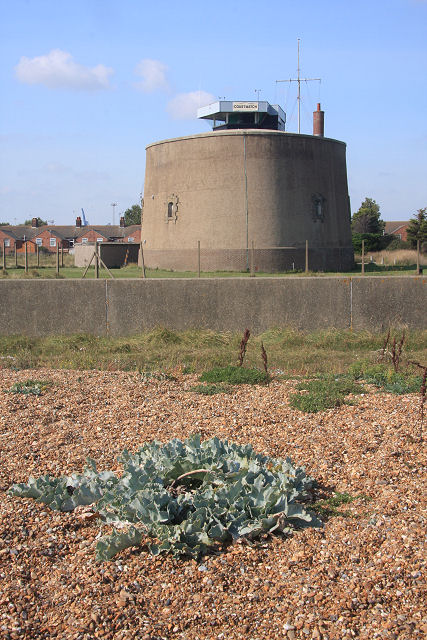
Image: © Bob Jones Taken: 26 Sep 2008
This Martello Tower at South Felixstowe is used by the National Coastwatch Institution. The station is manned by volunteers who assist HM Coastguard and the rescue services by maintaining a visual watch along the coastline. The visual lookout is situated 45ft above sea level. As well as locating people and vessels in difficulty volunteers help monitor and record local weather conditions. Each station is responsible for its own funding and the training of watchkeepers. Volunteers are all ages and come from many different walks of life. They are trained to look out for sea and shore users in trouble and must know how to deal with an emergency.
Images are licensed for reuse under creativecommons.org/licenses/by-sa/2.0
Image Location
Latitude
51.948932
Longitude
1.334817