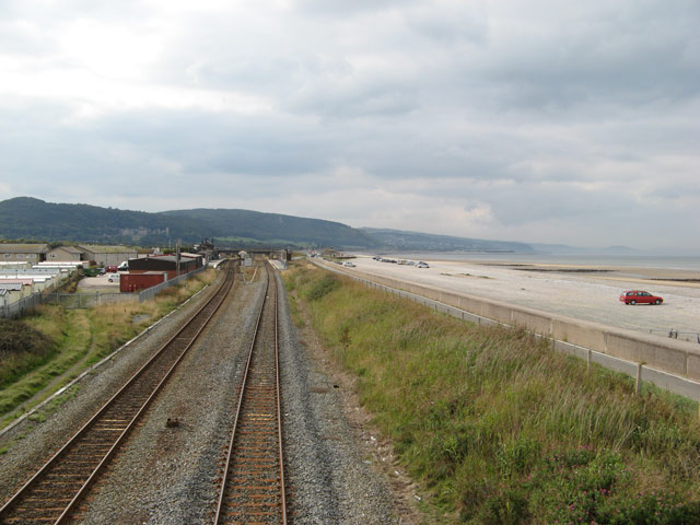
Railway line, Pensarn
Introduction
The photograph on this page of Railway line, Pensarn by Jonathan Wilkins as part of the Geograph project.
The Geograph project started in 2005 with the aim of publishing, organising and preserving representative images for every square kilometre of Great Britain, Ireland and the Isle of Man.
There are currently over 7.5m images from over 14,400 individuals and you can help contribute to the project by visiting https://www.geograph.org.uk

Image: © Jonathan Wilkins Taken: 25 Sep 2008
A capacious car park on the top of the beach stretches east from the railway bridge at Abergele & Pensarn railway station. The railway line follows the sea wall which was built to protect it, and the coastal path and cycleway run between them. The very wide spacing of the tracks follows from the fact that there were previously four tracks here, now reduced to two except at the station where there is still a loop for stopping trains in the Holyhead (down) direction.

