Mast Wreckage
Introduction
The photograph on this page of Mast Wreckage by Gerald England as part of the Geograph project.
The Geograph project started in 2005 with the aim of publishing, organising and preserving representative images for every square kilometre of Great Britain, Ireland and the Isle of Man.

There are currently over 7.5m images from over 14,400 individuals and you can help contribute to the project by visiting https://www.geograph.org.uk
Mast Wreckage
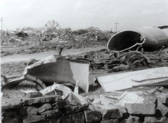
Image: © Gerald England Taken: 11 May 1969
Wreckage of the Emley Moor Mast, which crashed in March 1969, strewn across fields. For more information see John Carter's photograph Image taken a few week's earlier.
Images are licensed for reuse under creativecommons.org/licenses/by-sa/2.0
Image Location
Latitude
53.614257
Longitude
-1.667414