The Stuckie Bridge
Introduction
The photograph on this page of The Stuckie Bridge by Lairich Rig as part of the Geograph project.
The Geograph project started in 2005 with the aim of publishing, organising and preserving representative images for every square kilometre of Great Britain, Ireland and the Isle of Man.

There are currently over 7.5m images from over 14,400 individuals and you can help contribute to the project by visiting https://www.geograph.org.uk
The Stuckie Bridge
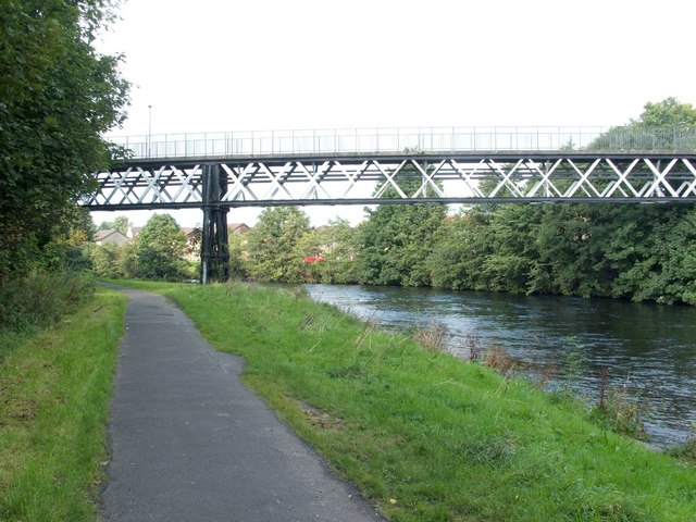
Image: © Lairich Rig Taken: 21 Sep 2008
The bridge crosses the River Leven, and leads from Rosshead to Jamestown. Rosshead is at its western end (on the left in this picture), and Jamestown at the eastern end. This was originally a viaduct for the Forth and Clyde Junction Railway; see Image for further details (and for a better picture). See also Image The end-note on NCN 7 refers to the cycle path that can be seen in the foreground.
Images are licensed for reuse under creativecommons.org/licenses/by-sa/2.0
Image Location
Latitude
55.997106
Longitude
-4.574115