Flooded footpath South West of Llanharry
Introduction
The photograph on this page of Flooded footpath South West of Llanharry by Mick Lobb as part of the Geograph project.
The Geograph project started in 2005 with the aim of publishing, organising and preserving representative images for every square kilometre of Great Britain, Ireland and the Isle of Man.

There are currently over 7.5m images from over 14,400 individuals and you can help contribute to the project by visiting https://www.geograph.org.uk
Flooded footpath South West of Llanharry
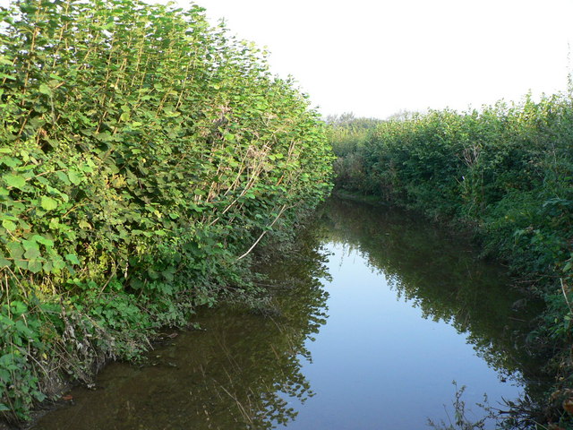
Image: © Mick Lobb Taken: 21 Sep 2008
The footpath follows a track that is blocked by a large iron gate before turning north-east then north. The track is then bordered by two hegerows but is heavily overgrown and soon becomes impassable. Further photographs show more of the track and path. The water was c.40 cms deep at this point!
Images are licensed for reuse under creativecommons.org/licenses/by-sa/2.0
Image Location


Leaflet Map data © OpenStreetMap
Latitude
51.502851
Longitude
-3.45726