Angle End Cottage
Introduction
The photograph on this page of Angle End Cottage by Keith Edkins as part of the Geograph project.
The Geograph project started in 2005 with the aim of publishing, organising and preserving representative images for every square kilometre of Great Britain, Ireland and the Isle of Man.

There are currently over 7.5m images from over 14,400 individuals and you can help contribute to the project by visiting https://www.geograph.org.uk
Angle End Cottage
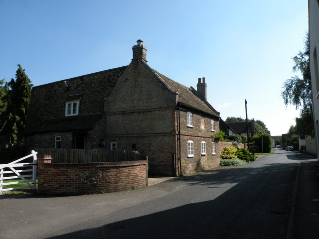
Image: © Keith Edkins Taken: 19 Sep 2008
House formerly the Grapes P.H., dated 1741 (see Image), enlarged late c1970's at rear. Gault brick with red brick dressings to doors, windows and quoins with steeply pitched plain tiled roof. Saw tooth eaves, cornice and end parapets on red brick kneelers. Grade II listed, LBS Number: 51496. http://www.heritagegateway.org.uk/Gateway/Results_Single.aspx?resourceID=5&uid=51496
Images are licensed for reuse under creativecommons.org/licenses/by-sa/2.0
Image Location
Latitude
52.194928
Longitude
0.267068