Lee Navigation: motorway bridge A102(M)
Introduction
The photograph on this page of Lee Navigation: motorway bridge A102(M) by Dr Neil Clifton as part of the Geograph project.
The Geograph project started in 2005 with the aim of publishing, organising and preserving representative images for every square kilometre of Great Britain, Ireland and the Isle of Man.

There are currently over 7.5m images from over 14,400 individuals and you can help contribute to the project by visiting https://www.geograph.org.uk
Lee Navigation: motorway bridge A102(M)
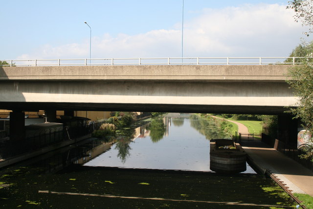
Image: © Dr Neil Clifton Taken: 18 Sep 2008
Taken from Eastway bridge, this shows the busy A102 Blackwall Tunnel Approach bridge, which some years ago was upgraded to motorway standard. Beyond this point the towpath has been closed, probably because of the Olympics, so northbound walkers face a diversion. Boats are not affected.
Images are licensed for reuse under creativecommons.org/licenses/by-sa/2.0
Image Location


Leaflet Map data © OpenStreetMap
Latitude
51.548646
Longitude
-0.027289