Old Toll House
Introduction
The photograph on this page of Old Toll House by Mike Kirby as part of the Geograph project.
The Geograph project started in 2005 with the aim of publishing, organising and preserving representative images for every square kilometre of Great Britain, Ireland and the Isle of Man.

There are currently over 7.5m images from over 14,400 individuals and you can help contribute to the project by visiting https://www.geograph.org.uk
Old Toll House
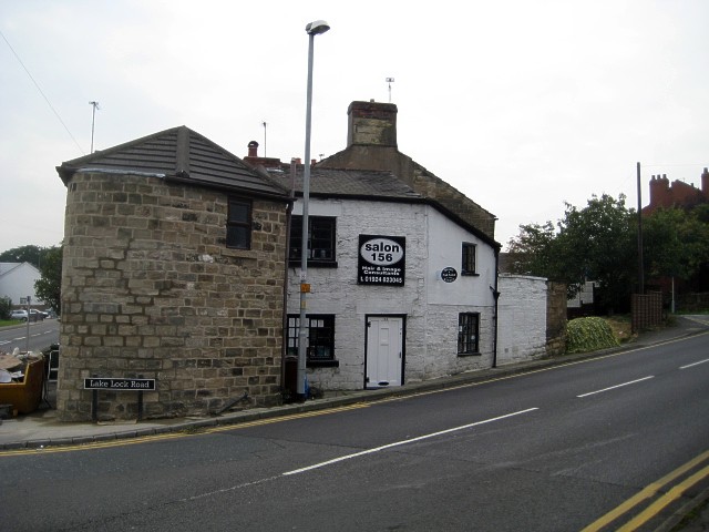
Image: © Mike Kirby Taken: 17 Sep 2008
The turnpike road, (now Aberford Road), ran through Stanley and was in use in 1770. The toll house was in use until 1870, when tolls were gradually abolished. The house is currently undergoing some renovation.
Images are licensed for reuse under creativecommons.org/licenses/by-sa/2.0
Image Location


Leaflet Map data © OpenStreetMap
Latitude
53.714663
Longitude
-1.469649