Approaching the Royal Border Bridge.
Introduction
The photograph on this page of Approaching the Royal Border Bridge. by Martin Addison as part of the Geograph project.
The Geograph project started in 2005 with the aim of publishing, organising and preserving representative images for every square kilometre of Great Britain, Ireland and the Isle of Man.

There are currently over 7.5m images from over 14,400 individuals and you can help contribute to the project by visiting https://www.geograph.org.uk
Approaching the Royal Border Bridge.
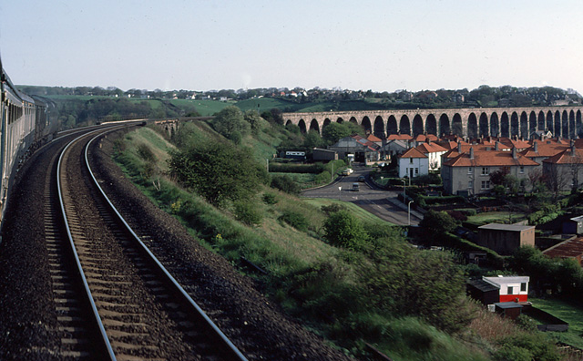
Image: © Martin Addison Taken: Unknown
A northbound express approaches the magnificent viaduct over the River Tweed. In the foreground, on the right is Osborne Road leading to the Junction with the A698, Ord Drive, which passes under the railway just ahead of the locomotive. The road beyond the junction is West End Road.
Images are licensed for reuse under creativecommons.org/licenses/by-sa/2.0
Image Location
Latitude
55.766923
Longitude
-2.015912