Banks Road
Introduction
The photograph on this page of Banks Road by Martin Addison as part of the Geograph project.
The Geograph project started in 2005 with the aim of publishing, organising and preserving representative images for every square kilometre of Great Britain, Ireland and the Isle of Man.

There are currently over 7.5m images from over 14,400 individuals and you can help contribute to the project by visiting https://www.geograph.org.uk
Banks Road
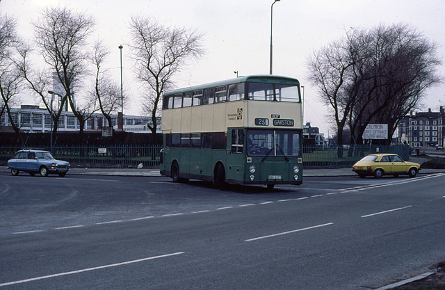
Image: © Martin Addison Taken: Unknown
A Merseyside Transport bus at the junction with Speke Road. The vehicle, fleet number 1837, is an East Lancs-bodied Leyland Atlantean. Behind on the right is the Bryant & May match factory, built in 1919-21. It closed in 1994 and is now a business park. The tenement blocks on the left have been replaced by modern low-rise housing.
Images are licensed for reuse under creativecommons.org/licenses/by-sa/2.0
Image Location


Leaflet Map data © OpenStreetMap
Latitude
53.350244
Longitude
-2.883278