South from the Cran Hill
Introduction
The photograph on this page of South from the Cran Hill by Iain Millar as part of the Geograph project.
The Geograph project started in 2005 with the aim of publishing, organising and preserving representative images for every square kilometre of Great Britain, Ireland and the Isle of Man.

There are currently over 7.5m images from over 14,400 individuals and you can help contribute to the project by visiting https://www.geograph.org.uk
South from the Cran Hill
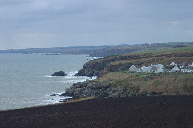
Image: © Iain Millar Taken: 27 Dec 2005
Looking south from the slopes of the Cran Hill, the rugged nature of the east coast of Scotland can be seen clearly in this photograph. The village on the headland is the lower part of Newtonhill, or perhaps Skateraw, the old name for this village. In the distance, someone with a keen eye and a good knowledge of the area might just be able to discern where the Highland Fault Line ends, near Stonehaven. I can't!
Images are licensed for reuse under creativecommons.org/licenses/by-sa/2.0
Image Location


Leaflet Map data © OpenStreetMap
Latitude
57.028927
Longitude
-2.143304