Post Box, Boulby
Introduction
The photograph on this page of Post Box, Boulby by Mick Garratt as part of the Geograph project.
The Geograph project started in 2005 with the aim of publishing, organising and preserving representative images for every square kilometre of Great Britain, Ireland and the Isle of Man.

There are currently over 7.5m images from over 14,400 individuals and you can help contribute to the project by visiting https://www.geograph.org.uk
Post Box, Boulby
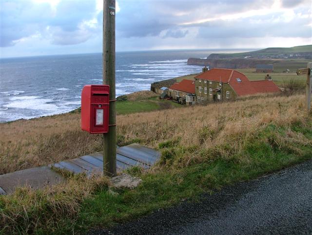
Image: © Mick Garratt Taken: 27 Dec 2005
Looking east towards Cowbar Nab and Staithes. The large house is the former alum house, now a private residence. It once comprised several ranges of single storey buildings. This three storey building was probably a store for barrels of the finished product. Later it was used as a stable for the ironstone mine. Liquid alum was culverted from the workings to the alum house where further refining took place. Somewhere on the "lawn" this side of the house (to the right of the post box) a vertical shaft was sunk in 1683 leading to a tunnel at the bottom of the cliff 100' below. A horse gin would have operated to drop the barrels of alum down to waiting boats. The shaft would also have been used to haul up the urine from the streets of London needed for the crystallization process. There is no sign of the shaft today.
Images are licensed for reuse under creativecommons.org/licenses/by-sa/2.0
Image Location


Leaflet Map data © OpenStreetMap
Latitude
54.560536
Longitude
-0.826248