Whiteadder Water leaving the Lammermuir Hills
Introduction
The photograph on this page of Whiteadder Water leaving the Lammermuir Hills by Richard Webb as part of the Geograph project.
The Geograph project started in 2005 with the aim of publishing, organising and preserving representative images for every square kilometre of Great Britain, Ireland and the Isle of Man.

There are currently over 7.5m images from over 14,400 individuals and you can help contribute to the project by visiting https://www.geograph.org.uk
Whiteadder Water leaving the Lammermuir Hills
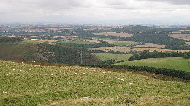
Image: © Richard Webb Taken: 12 Sep 2008
A view from Cockburn Law, showing the river leaving the uplands for the Merse,a rich agricultural plain. The sheltered steep sided valley of the Whiteadder has been used as a pylon route from Torness power station. The power lines are bound for Eccles substation near Coldstream.
Images are licensed for reuse under creativecommons.org/licenses/by-sa/2.0
Image Location


Leaflet Map data © OpenStreetMap
Latitude
55.818669
Longitude
-2.366549