Coal Road, Auchinleck
Introduction
The photograph on this page of Coal Road, Auchinleck by A-M-Jervis as part of the Geograph project.
The Geograph project started in 2005 with the aim of publishing, organising and preserving representative images for every square kilometre of Great Britain, Ireland and the Isle of Man.

There are currently over 7.5m images from over 14,400 individuals and you can help contribute to the project by visiting https://www.geograph.org.uk
Coal Road, Auchinleck
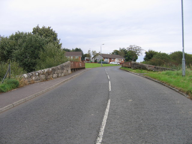
Image: © A-M-Jervis Taken: 15 Sep 2007
Coal Road, on the south side of Auchinleck, crosses two railway bridges, one still very much in use over the main line between Kilmarnock and Dumfries. This is the other one and once passed over the line between Auchinleck and Muirkirk. The last part of this line closed at the end of 1976 when a coal mine at Gasswater, near Cronberry, ceased production, and the track was taken up. About twenty years later it was proposed that the line be re-laid to serve planned opencast mining at Gasswater and Powharnol. However, delays followed delays and the re-opening never happened, although the opencasting went ahead, served by road. It would be more difficult to re-open the line now as this bridge has since been infilled with stones and concrete.
Images are licensed for reuse under creativecommons.org/licenses/by-sa/2.0
Image Location
Latitude
55.469341
Longitude
-4.282637