Hillside on the east side of the Walsden Valley opposite Gauxholme, Todmorden
Introduction
The photograph on this page of Hillside on the east side of the Walsden Valley opposite Gauxholme, Todmorden by Humphrey Bolton as part of the Geograph project.
The Geograph project started in 2005 with the aim of publishing, organising and preserving representative images for every square kilometre of Great Britain, Ireland and the Isle of Man.

There are currently over 7.5m images from over 14,400 individuals and you can help contribute to the project by visiting https://www.geograph.org.uk
Hillside on the east side of the Walsden Valley opposite Gauxholme, Todmorden
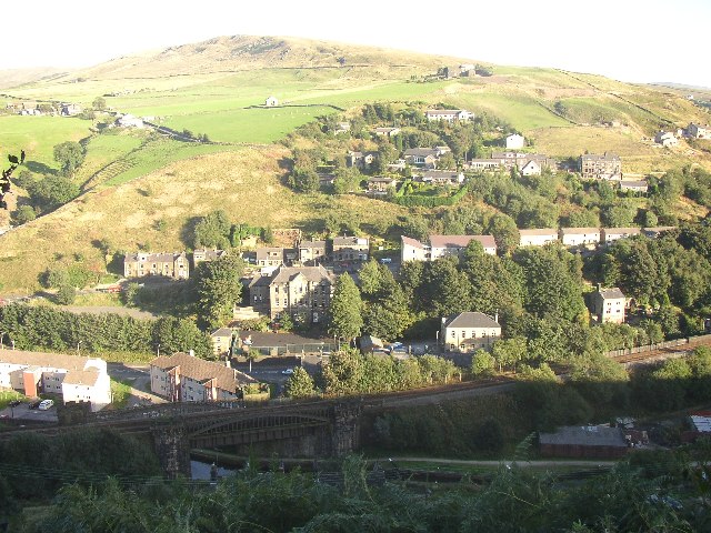
Image: © Humphrey Bolton Taken: Unknown
This view shows (1) how the road, railway and canal compete for space in the valley bottom, and typical redevelopment of 19C industrial land. (2) development even on a steep hillside (3) a less steep slope halfway up the hillside, where there are farms and pastureland. (4) moorland at the top of the hillside. At the bottom of the pasture towards the left there are a series of steps across the field that I think must be minor landslips rather than cultivation terraces.
Images are licensed for reuse under creativecommons.org/licenses/by-sa/2.0
Image Location


Leaflet Map data © OpenStreetMap
Latitude
53.704285
Longitude
-2.104484