Looking back along the Clyde Walkway
Introduction
The photograph on this page of Looking back along the Clyde Walkway by Lairich Rig as part of the Geograph project.
The Geograph project started in 2005 with the aim of publishing, organising and preserving representative images for every square kilometre of Great Britain, Ireland and the Isle of Man.

There are currently over 7.5m images from over 14,400 individuals and you can help contribute to the project by visiting https://www.geograph.org.uk
Looking back along the Clyde Walkway
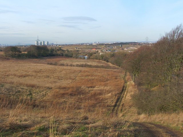
Image: © Lairich Rig Taken: 10 Feb 2006
This photograph was taken on a winter afternoon while following the Clyde Walkway towards Uddingston; this section of the route ascends the slopes of Honeyhill Plantation. The Walkway, as marked on maps, sticks more closely to the course of the River Clyde. However, the flat ground near the river can be extremely marshy and overgrown with reeds, and the route shown here, following the upper margin of a wooded slope, is more often followed instead. The photo shows the view seen when turning back to look along the course of the Walkway. From the heart of Glasgow, to a disused railway viaduct that crosses the River Clyde at Carmyle, the course of the Walkway coincides with Route 75 of the National Cycle Network. However, at the southern end of the viaduct, the Walkway continues over rough fields, while the cycle route follows a different and more easily traversed route through Newton (about 1 km south from here). The two routes join up again at Blantyreferme, about a mile SE of this point.
Images are licensed for reuse under creativecommons.org/licenses/by-sa/2.0
Image Location
Latitude
55.828406
Longitude
-4.121926