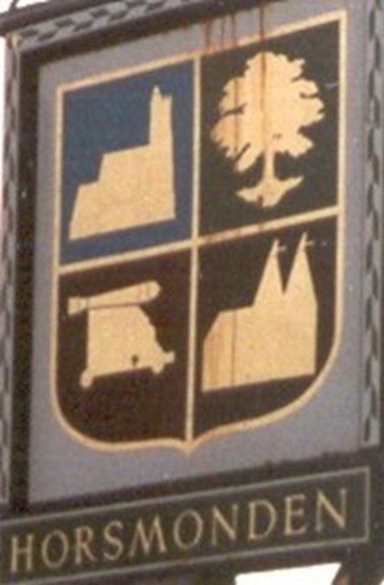
The quarters of Horsmonden?s village sign
Introduction
The photograph on this page of The quarters of Horsmonden?s village sign by D Gore as part of the Geograph project.
The Geograph project started in 2005 with the aim of publishing, organising and preserving representative images for every square kilometre of Great Britain, Ireland and the Isle of Man.
There are currently over 7.5m images from over 14,400 individuals and you can help contribute to the project by visiting https://www.geograph.org.uk

Image: © D Gore Taken: Unknown
The CANNON represent the great iron foundry, which once supplied guns here for the English and Dutch navies and for King Charles I’s army and later, during the English Civil War, for Parliament. In 1613 two hundred men were employed in the foundry. See Image and Image The TREE represents Horsmonden's great oaks and other local woods used for building, for gun carriages and for fuelling John Browne’s great blast furnace. The OASTHOUSE of course represents agriculture and the thriving hop industry The CHURCH is presumably the 14th century parish church of St Margaret which, surprisingly, lies some two miles away from the present Horsmonden village. This is explained at Image Also see Gallery at: http://www.geograph.org.uk/gallery/the_history_of_horsmonden_8738 and article on Horsmonden at: http://books.google.co.uk/books?id=2_ZstVBZSfIC&lpg=PA1&pg=PA99#v=onepage&q=&f=true

